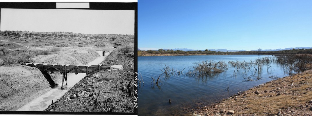
The structures seen in
the photo on the left taken in 1906 were 13G, a 48" Drainage
Flume, in the middle distance 13F, a 50' cut and cover,
and then in the far distance 13E, a 489.4' tunnel. This location
is just north of the main Windy Hill Campground, which in January,
2011
was under water. I was able to locate these structures, by
looking at the listing of all the structures. This was the only
location that had
this sequencing of these kinds of features