 |
The March
22, 1866 Apache Ambush
Of A US Army Escort
|
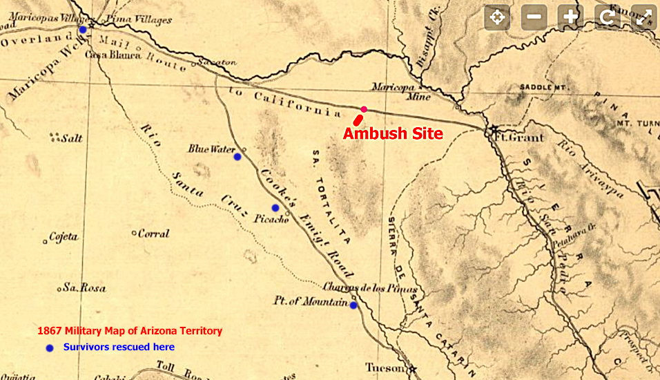
On March 22, 1866 an Army wagon carrying 9 soldiers and a teamster driver was ambushed by a large group of Apaches in Cottonwood Wash approximately 30 miles west of Fort Grant. The soldiers were serving as an escort for two officers who had been recently assigned to the infantry regiment stationed at the fort. One of the officers, Captain Frank Millar, was killed along with three other soldiers in the attack. Four of the soldiers, the teamster, and the second officer Assistant Surgeon Benjamin Tappan Jr managed to escape and flee out into the desert away from the wash. Dr. Tappan had suffered three wounds.
I was told about this incident in 2017 by Doug Hamilton who lived in Kearny not too many miles north of the ambush site. Mr. Hamilton had studied the history of the attack, located the site, and had published a paper on his findings in 2009. I have lost contact with Mr. Hamilton in the years since, but in 2022 I found a copy of his report. There was enough information provided that I was able to find the ambush site and visit it in person. Much of what which is presented here is from Mr. Hamilton's paper: "The Military Debacle In Cottonwood Wash". In 2010, Mr. Hamilton published an article that was adapted from his original paper. That article can be found online at this link.
A Bit More Background:
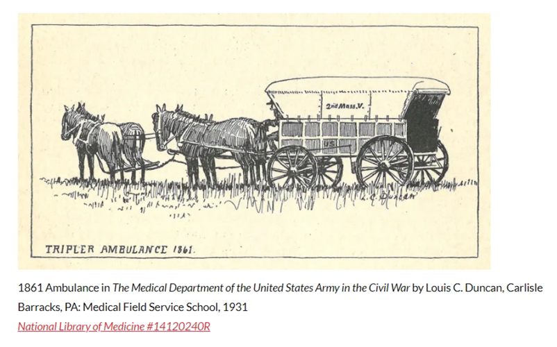
The wagon carrying the men of the escort was a civil war era Army wagon pulled by 4 mules. A newspaper article, (The Montana Post, May 19, 1866), described the wagon as being an "ambulance". The wagon may have looked like the one in this drawing.
 |
Fort Yuma on the Colorado River had been the starting point for the escort 15 days prior to the ambush. The soldiers had followed the route established by the Overland Mail Company several years before. Except for the civilian driver, the soldiers were all a part of the 14th Infantry. The group did not carry a lot of gear. Meals and other supplies were obtained from the stage stations along the way. There were no soldiers riding alongside the wagon to act as lookouts or "skirmishers".
At the Pima Villages, the group was warned that there had been Apache activity on the section of the route west of Fort Grant. Just beyond Sacaton, the escort could have turned south to Tucson and added more soldiers from the units stationed at Fort Lowell. The group, however, chose to stay on the more direct route to Fort Grant.
The Ambush Site:
When the first survivors of the ambush were able to make contact with the outside world, Captain Jonathan B. Hager and 20 soldiers from Fort Lowell plus another complement of soldiers from Fort Grant were dispatched to locate the site of the ambush and to look for other survivors. The Captain kept a diary with detailed notes on what he found during his search and rescue operation. The information contained in the Hager diary allowed Mr. Hamilton to recreate the sequence of events that had occurred during the ambush.
As the escort made its way up the section of the road that was in Cottonwood Wash, the soldiers were unaware that they had been spotted by Apache scouts who were riding out ahead of a larger group of warriors traveling down the wash. The scouts reported to their leaders that the Army unit was small and that there were four mules available for the taking. The Apaches could not resist the opportunity. An ambush was setup and the wait began for the army escort to arrive.
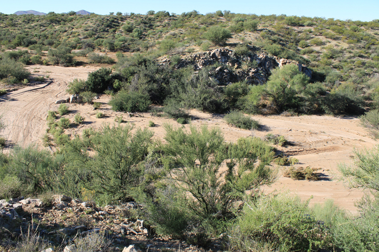
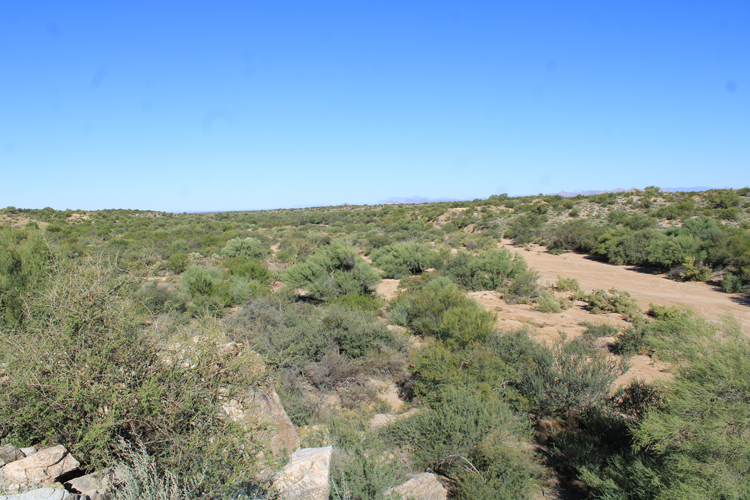
At the site chosen for the surprise attack, the sides of the wash are dramatically closer together than they are upstream or downstream. The wash becomes a narrow gap that runs between two rock formations. This narrow section is approximately 220' wide. From the outcrops, the Apaches had clear lines of sight to fire down onto the unsuspecting soldiers.
Captain Hager clearly identified the two outcrops on his diagram/map of the ambush scene. This photo was taken from the top of the one on the north side of the wash looking across the narrow gap to the rock formation on the south side. The Army wagon was traveling up the wash from the right edge of the photo. To the left of the south outcrop, there was a sharp curve in the wash where the Apaches had hidden their horses. It can be seen the advantage the Apaches had from their elevated positions.
 |
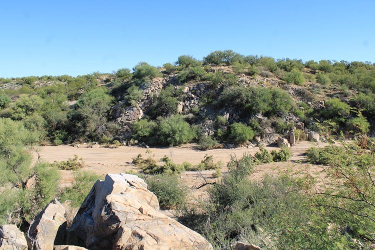
This is the opposite view across the narrow gap from the south outcrop to the north formation. On his diagram, Captain Hager drew a small "arroyo" running along the base of that formation. He wrote that in addition to the Apaches on the outcrops, there were many hidden in the arroyo at wash level.
 |
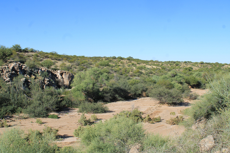
Captain Hager found the bodies of Captain Millar, and two of the other soldiers in the wash on the downstream side of the south rock formation. The wagon and a butchered mule were also found there. That area can be seen in the foreground of this photo that was taken from the top of the south outcrop.There is no indication on Hager's diagram as to what the situation was with the plant growth in the wash.
 |
The body of the fourth soldier was found on the hillside above the ones in the wash. That hillside is in the distance in this photo. Apparently, the soldier was in the group who had escaped the attack, but had stopped to provide covering fire and was killed. The other surviving soldiers made their way up one of the ravines and escaped out into the desert.
 |
The Apaches were quite harsh in their treatment of the dead soldiers. Captain Hager reported that the men had been stripped and their bodies mutilated. One of the soldiers appeared to have been scalped while he was still alive. The Apaches then shot the dead soldiers full of arrows.
Before leaving the scene in Cottonwood Wash, the Apaches butchered the dead mule and removed the harnesses from the others. The mules were taken by the Indians as they exited the location to the north side of the wash. An empty trunk that had belonged to Captain Millar was found out in the desert in that direction.
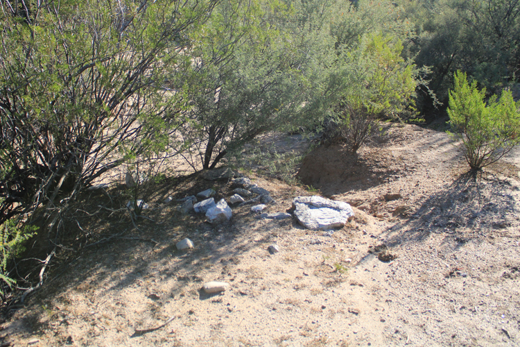
Except for these stones, there are few artifacts left at the site of the ambush. These had been used to mark the grave of one or two of the soldiers buried by the search party led by Captain Hager. In 1867, the bodies were recovered and re-buried elsewhere. Captain Millar was re-buried in his home town.
 |
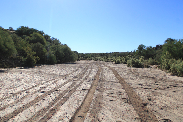
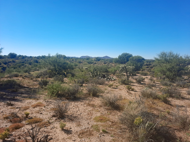
ATV tracks in the wash where the ambush occurred are the only signs of the modern world that occur at the ambush site. There are no roads, mines, water tanks, houses or corrals in the immediate area. Overall, the site could be pretty much like it was during the time of the attack. This is the view looking into the narrow section of Cottonwood Wash that the soldiers would have had just prior to being ambushed.
 |
The survivors:
Six of the men were able to escape and flee out into the desert to the south of the wash. They were fortunate that the Apaches did not pursue after them. One of the soldiers perhaps dazed by a head wound wandered away from the group. Somehow, days later he showed up at Maricopa Wells many miles north of the ambush site. Unfortunately, he died from his wounds shortly afterwards.
The group did not try to travel back in the direction from which they had come. Instead, they walked to the southwest. The injured Dr. Tappan was barely able to walk. On the Saturday following the attack, he was no longer able to move and ordered two men to leave the group and go search for water. They became lost, but spotted Picacho Peak in the far distance. They walked toward the peak arriving there the next day. Picacho Peak was 30 miles from the ambush site. A passing army unit found the two men, and dispatched the news of the ambush to Tucson.
While the search and rescue operation was being organized, word was received that one of the last two privates who had remained with the doctor had been found at Point of Mountain northwest of Tucson. The private reported that he and the other soldier had been ordered by the doctor to leave him alone and to try and save themselves. The second soldier arrived at Blue Water soon after. A very lengthy search for the doctor was conducted, but he was never found.
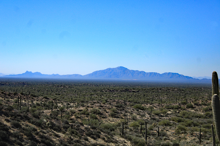
This is the view southwest from the ambush site. Picacho Peak is in a direction over the horizon to the right of the distant hills. That the men who had survived the ambush were able to reach the peak and the other places in that direction, on foot, with no water or other supplies is pretty remarkable.
 |
The first soldiers to reach safety and tell the story of the ambush walked to Picacho Station near Picacho Peak. The station was 30 miles from the ambush site. This photo was taken a little more than 20 miles from the peak. The view could be very similar to the one the soldiers had.
 |