 |
180 Miles
on the Arizona Trail-- Mexican Border to Tucson |
|
|
180 Miles
on the Arizona Trail-- Mexican Border to Tucson |
|
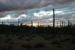
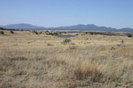
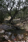
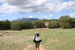
The Arizona Trail is an 800 mile hiking, equestrian, and bicycle route that runs across Arizona from Mexico to Utah. Its southern most point is at Border Monument 102 south of Sierra Vista Arizona and the northern terminal is near the Paria River in Utah a long ways away.The trail is segmented into 43 passages with Passage 10 ending near Tucson. It was my goal to hike those passages from the border to Tucson.
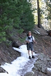
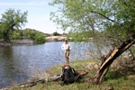
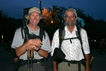
On March 27th 2004, Neil F. and I started northward on foot. Neil backpacked with me to Canelo Pass about 43 miles away. That got us through the first two passages which included hiking over the Huachuca Mountains and bypassing Parker Canyon Lake. On this hike which took us four days, we had two illegal alien encounters(they were heading south), saw tons of their trash, and made contact with my wife who brought out a fuel container that I had forgotten in the truck when she had dropped us off. The hike across the Huachucas was very strenuous! It would have been much nicer if it had not come on days1 and 2 of the hike. On our second day, we crossed paths with a southbound traveler who had started in Utah 39 days earlier and was going to make the border on his 40th day out for his 40th birthday. In addition to hiking, he had ridden horseback and a mountain bike in order to cover the entire distance across the state in such a short amount of time!
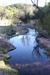
At Canelo Pass Neil returned to Tucson. I spent the next 1 1/2 days crossing the Canelo Hills West Passage of about 17 1/2 miles to the small town of Patagonia. On this passage, I shared the trail for a distance with a group of about 30 aliens. There was no incident. I spent the second night of this passage in a motel at Patagonia, and met up with my son who re-supplied me for the next segments. He also took a couple of hikers who had found the walking too difficult out to pick up their car.
 |
 |
 |
 |
 |
 |
 |
 |
 |
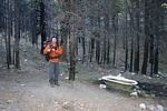
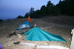
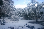
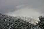
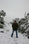
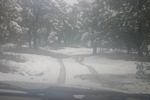
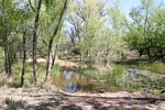
On April 1st, six days from the border, I hiked about 15 miles of the Temporal Gulch Passage to Bear Spring. It was an excellent campsite with running water. Sometime that night it began to snow. It was still snowing by morning. I thought that I would wait it out. But that night the snow was still coming down. Since I didn't know what the forecast was and was now off schedule to meet my son at Highway 83, I climbed a hilltop and was able to put a call through to have him pick me up the next day, April 3rd, at Tunnel Springs on the Gardner Canyon Road.
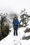
All of my euipment worked well and I stayed comfortable for the entire time. I was particularly pleased that even though my tarp tent did not have a floor that I was able to stay dry. The next morning I was able to see the outline of the trail enought to make my way the few miles to Tunnel Springs road. The weather still had not really cleared up. Having trekking poles probably helped to keep from slipping and sliding too much
When Jerry picked me up I had walked about 80 miles from the border.
 |
 |
 |
 |
 |
 |
 |
 |
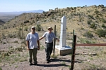
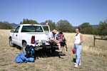
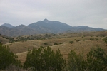
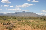
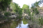
On April 6, Neil and I were driven back out to Tunnel Spring where we started our walk on the Santa Ritas Passage which is about 17.2 miles long. From Tunnel Spring the path wanders past Kentucky Camp and several other old mines and then out to Oak Canyon at Highway 83. We took about a day and a half to do the trip. Neil picked up his truck along the side of the highway and left me to continue walking alone. I hiked eastward for the rest of that day on to the Cienegas Passage, which in 2004, continued east under the highway to Cienega Creek and then north and east to the J Six Ranch exit on interstate 10. On April 8th, I was to my truck at my sister's house at J-Six which was about 31 miles from where I had left Neil. Although, it had not been continuous, I was feeling pretty good about chalking up 127 miles of the trail over 10-11 days of actual hiking.
 |
 |
 |
 |
 |
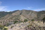
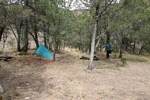
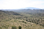
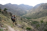
It wasn't until April 23rd, that I was able to pick up the hike at J-6 exit and walk the Happy Valley Road about 17 miles northward to the trail needed to cross over the Rincons. Neil joined me that evening. The next day we walked over the Rincons into the Redington Pass area, 15 very steep miles. This was my first time to Manning Camp. On April 25th we picked up and hiked approximately 11 miles to camp at Caliente Creek. And then on April 26th, we hiked 18 very long miles through the Molino Basin Campground, the Prison Camp, Sycamore Reservoir ,Sabino Basin and out to our pickup ride at the entrance to Sabino Canyon. From Molino Basin westward, the vegetation had been destroyed by an earlier fire and subsequent flooding had altered the terrain. In those areas the trail was very difficult to pick up and caused us quite a delay.
 |
 |
 |
 |
 |
 |
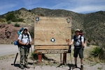
So the mileage total from the Mexican border to Tucson was about 180-190 miles. We had done it in three sessions with 15 days spent on the trail. I had walked quite a large part of the distance alone and had learned that I felt pretty comfortable doing that. The route of the trail was not one that I would have laid out if my challenge had been just to get from Mexico to Utah. For those purposes the route rambled east and west far too much. I also probably would not have chosen to go over the mountain ranges along the way, but would have gone around them! But all in all, I felt that it had been a worthy challenge and was quite glad that I had taken it on.
| Trips |
| Home |