 |
Courthouses,
Train Stations, and Bench Marks
(1899-1915)
|
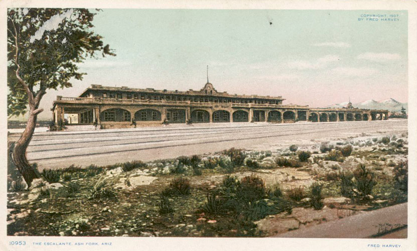
In 1915, the US Geological Survey released Bulletin 573 that documented the locations of more than 1500 elevation benchmarks that had been set out across Arizona. Particularly interesting were the twenty or so markers that had been attached to the walls of courthouses, train stations, and other buildings. The Harvey House in Ashfork, shown in the post card view above, was one of those. A list of the buildings that were associated with a benchmark can be found here.
 |
How many of the building/benchmark pairings still exist? Online searches into the histories of the buildings and a check of the current status of the benchmarks suggest that fewer than 1/3 have survived. In most cases, the benchmark disappeared when the building was demolished or severely modified. These are some of the more notable examples that have not survived.
--Ashfork Harvey House that was
demolished in 1968 despite efforts to save the building
--Pima County Courthouse demolished in the 1920s to make room for
a replacement building
--Maricopa County Courthouse demolished in the 1920s to make room
for a replacement building
--Citizens Bank Building in Flagstaff that was severely remodeled
in the 1950s, benchmark disappeared
--United Verde Company Office in Jerome that may survive, but
there is not a current record of the benchmark's status. Access
to this building is restricted.
--Prescott, the original courthouse was taken down and replaced,
the benchmark survives.
Making it through to today are the buildings and benchmarks below. The survival of these buildings has not been by accident. Each has received attention and care. All are functional with several still serving their original purpose.
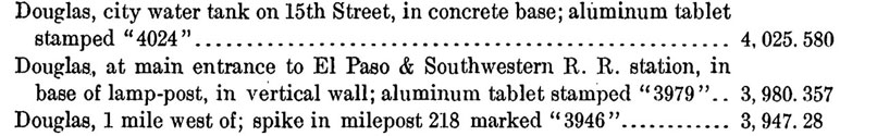
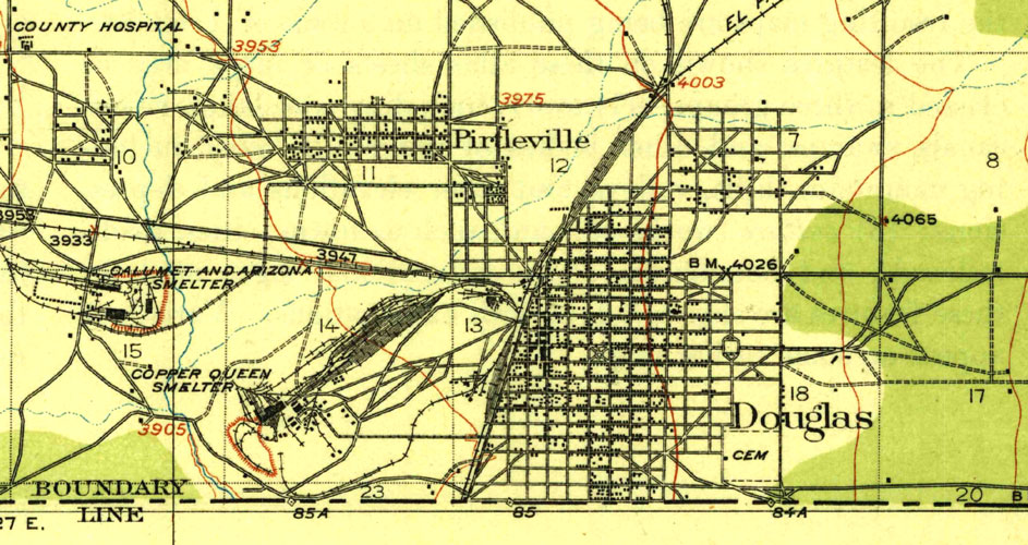
Railroad Depot--Douglas Arizona:
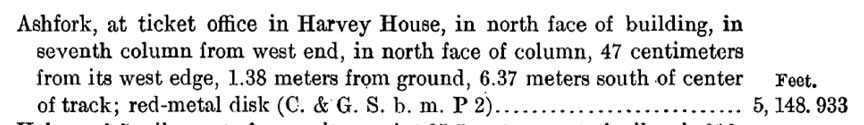
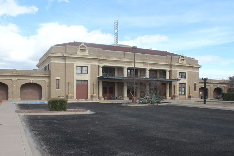
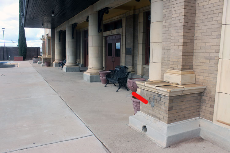
This section of Bulletin 573 documented the placement of three benchmarks in Douglas in 1912. Benchmark 3979 was attached to the El Paso & Southwestern Passenger Depot. In the early part of the 20th century, the railroad line, owned by the Phelps Dodge Mining Company ran trains between Tucson and El Paso. This building, which was opened in 1913, was the flagship station for the company. Today, it is used as the headquarters for the Douglas Police Department. The building is listed in the National Register of Historic Places. A description of the history and the architecture of the building can be found here.
 |
 |
This is the location of BM 3979. The benchmark would have been set and the elevation at the center of the marker would have then been determined. In those years, there were no instruments available that could directly take elevation readings. Elevations were determined by "Spirit Leveling".
 |
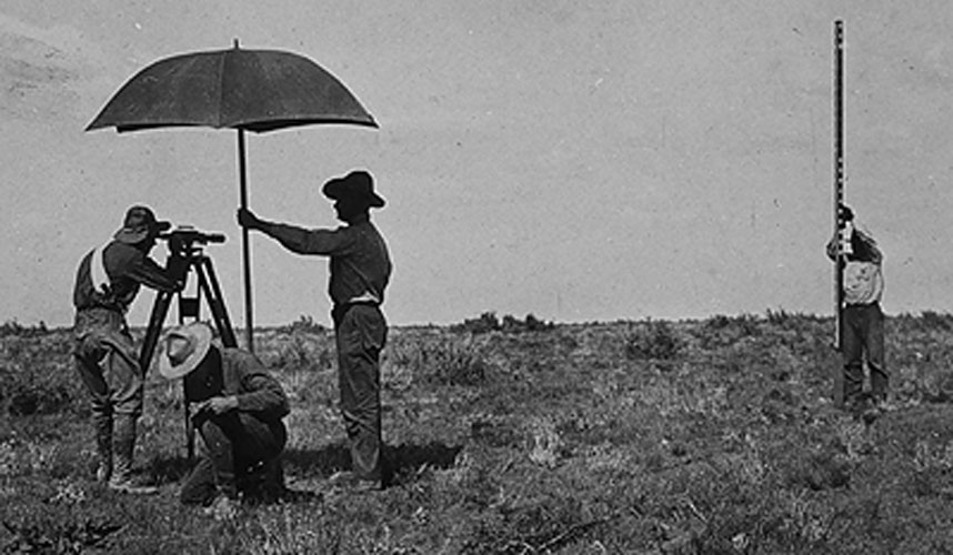
A Spirit Leveling Crew at work is the subject of the photo below. There were two essential pieces of equipment. The "spirit level" was a special telescope that was outfitted with a liquid bubble level. The term "spirit level" came from the use of alcohol as the liquid in the level. A vertically held ruler, called a "rod" was the other important piece of equipmnt. In order for the readings taken through the telescope to be accurate, it had to be oriented in a perfectly horizontal position. The use of the bubble level made that adjustment possible. The umbrella was used to shade the telescope and keep it in calibration.
 |
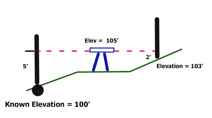
This diagram shows how the spirit level and the rod were used to determine elevation:
1. The Spirit Level was set up
at a location in which there were sight lines back to a location
whose elevation was known and forward to a location that the
elevation was unknown.
The telescope was adjusted to "level".
2. A sighting was taken back to a rod as it was held over the known elevation. The value read on the rod was added to the known elevation. That became the elevation of the telescope.
3. The telescope was then rotated and a reading was made forward to a rod standing at the unknown elevation. The reading through the telescope to the rod was subtracted from the height of the telescope to produce the elevation at the base of the rod. This "unknown" elevation was then a "known".
4. These steps were repeated as many times as necessary to complete the survey.
 |
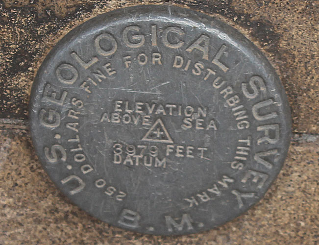
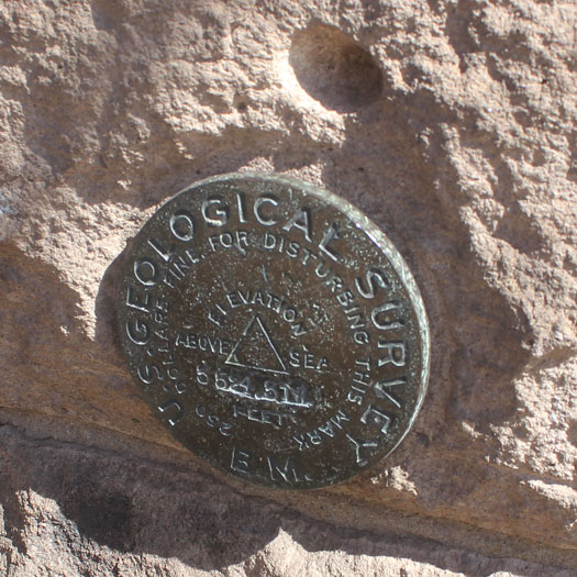
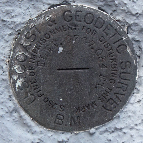
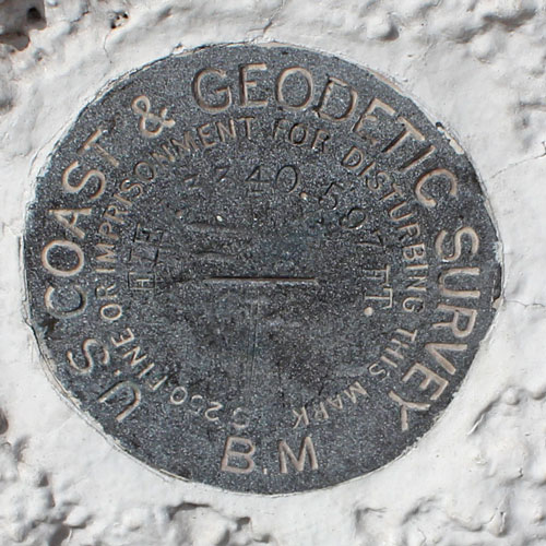
Those benchmarks described as tablets were circular in shape and measured 3 1/2" in diameter and were 1/4" thick. Aluminum and bronze were the metals used in the fabrication of the markers. A 3" stem that extended from the back of the disk allowed the benchmarks to be mounted into drilled holes in masonry or stone.
The numbers stamped on the tablet were "rounded" values of the elevation. The actual elevations were recorded in the bulletin. It is pretty interesting that the instrumentation of the times could read to the hundredths of a foot. Estimations were made out to the thousandths. Surveyors were instructed to treat the numbers stamped on the disks as "descriptive" terms, not numerical values.
 |
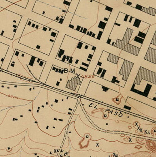
This is a section of the Douglas Quadrangle that was published in 1914. Two of the entries from the listing above made it on to the map. The notation "B.M. 4026" is the rounded value of the elevation at the tablet that was stamped "4024". "3947" represents the elevation of the spike, west of town, that was stamped "3946", Missing is the notation for the benchmark that was located on the wall of the depot. Apparently, it was not unusual for benchmarks to be omitted from the maps. The depot marker would have been located near the railroad shown midway between the other two.
Entries in the bulletin were written in the order that the benchmarks were established. The three stations, described above , would have been set from east to west as the surveyors worked their way across the town.
 |
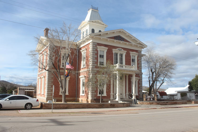
Cochise County Courthouse at Tombstone
To the northwest of Douglas, in the town of Tombstone, is the historical Cochise County courthouse that was built in 1882. The building was retired when the county seat was moved to Bisbee. It is now one of Arizona's State Historical Parks. The exterior appearance of the building has changed little from its earliest days. The benchmark on this building was established in 1903.
 |
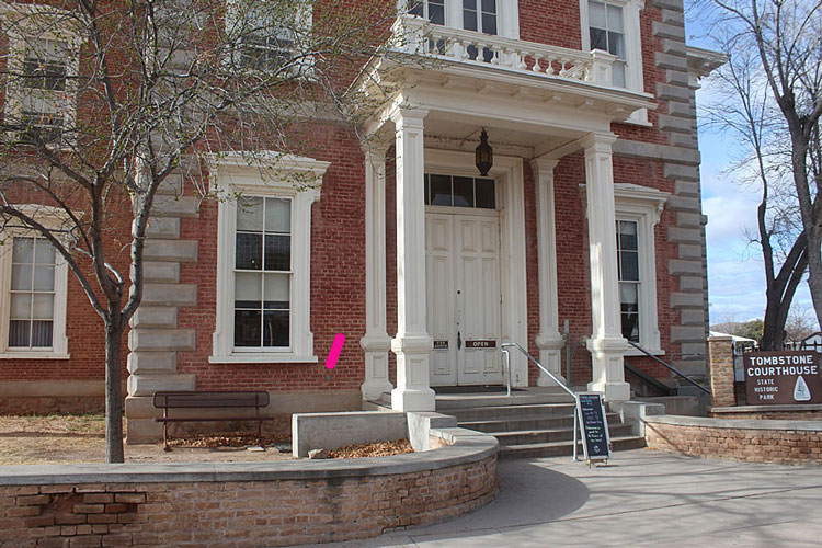
 |
Note that the rounded value for the elevation that was stamped on the benchmark is not anywhere close to the actual value recorded in the bulletin. The letters "Nogls" indicate that the elevation of the courthouse benchmark was intially determined from a reference mark in Nogales--most likely one of the border monuments. At some point, it was discovered that the elevation of the reference marker had not been accurately determined. The error was huge!
Rather than change out all of those benchmarks that were "descended" from the Nogales mark, surveyors were instructed NOT to use the values stamped on the benchmark tablets, but were to use the corrected values printed in the bulletin.
The red line points to the location of the benchmark.
 |
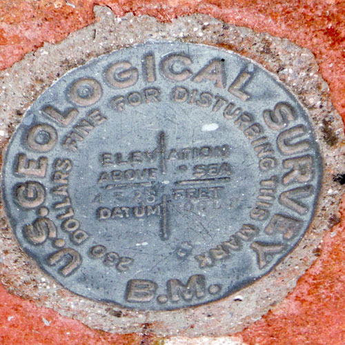
At some point in this benchmark's history was it the victim of an assault? The surface looks like it has been seriously pounded on....
 |
Benchmark 4526 was included in the Tombstone Quadrangle topographic map when it was published in 1907. The corrected elevation value was not used. Why was that? There does not seem to have been a standardized protocol that the early mapmakers followed as far as the notation of the benchmarks on the maps.
 |
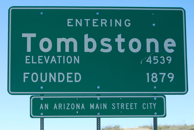
This sign on the outskirts of Tombstone is interesting. The elevation noted is that of the corrected value for the benchmark at the old courthouse. Are the elevations noted on other signs like this connected to places that are as interesting as this one?
 |
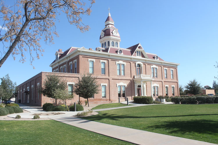
Pinal County Courthouse:
Also making the list of buildings that were paired with benchmarks, was the Pinal County courthouse in the town of Florence. This building was constructed in 1891. The benchmark was probably set sometime before 1901. The NGS datasheet has the date "monumented" as 1903, but that is probably not correct. The benchmark appears on the Florence Quadrangle that was surveyed in 1901. This building still functions as an active courthouse.
 |
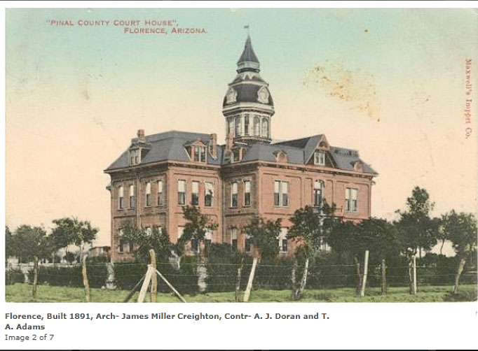
This would have been the appearance of the courthouse in Florence at the time that the benchmark was established. The southwest corner of the west wing is the edge of the building seen to the right in the photo. This photo is from the website: www.courthousehistory.com
 |
In 2018, this was the Pinal County Courthouse. There is quite a difference in the appearance from the original building! A pdf file that documents the history of this building can be found here
 |
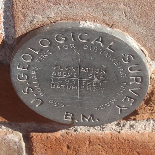
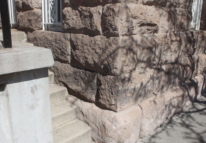
The benchmark is located in what had been the original southwest corner of the building. Its height above the ground does not quite match the 3' height as described in the bulletin.
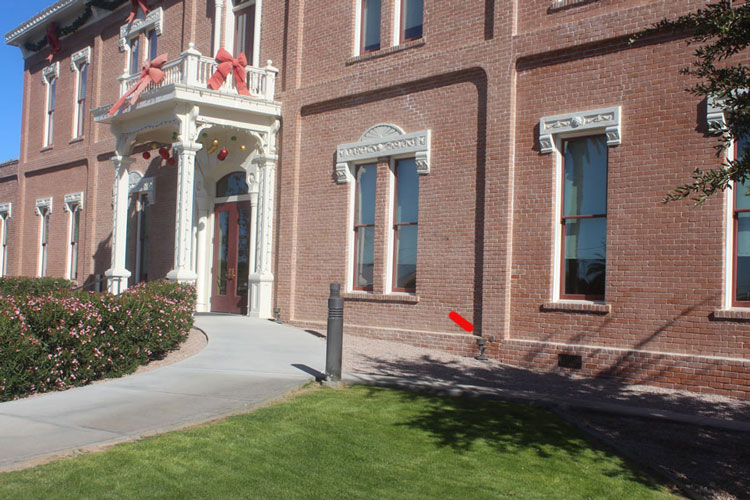 |
The vertical "crack" across the rows of bricks to the right of the benchmark is the seam between the original building to the left and an addition to the right. Except for the slight misalignment in the rows of bricks, there are few signs that the area to the right is not original.
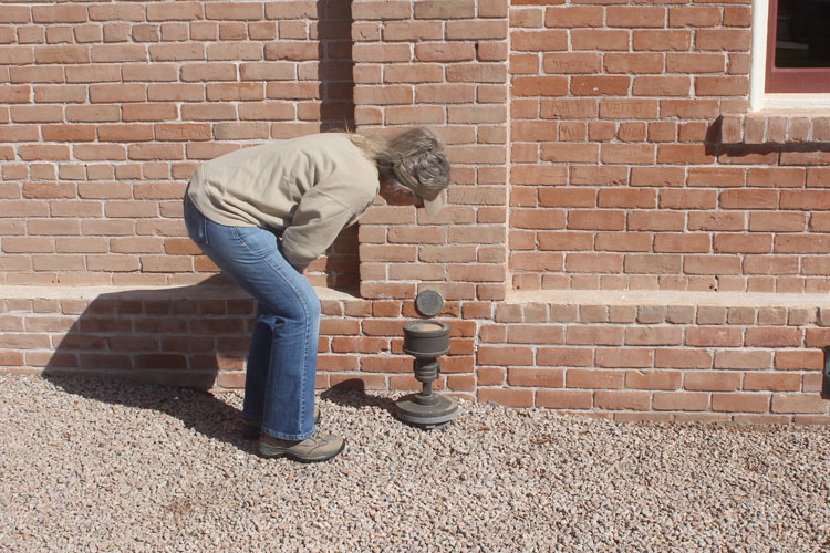 |
Several rows of bricks above the benchmark and to the right is a date with the year 1904 scratched into the surface. Would this be considered an act of vandalism or a historical inscription?
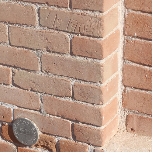 |
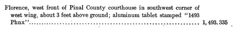
The letters "PHNX" stamped next to "DATUM" indicates that the elevation of 1493 feet had been determined from a reference benchmark In Phoenix. That benchmark was attached to a wall at the Maricopa County Courthouse. Many other benchmarks in this part of the state had that same connection to the PHNX benchmark. In my hometown area near Winkelman, there were benchmarks with both PHNX and the NOGLS stamps.
 |
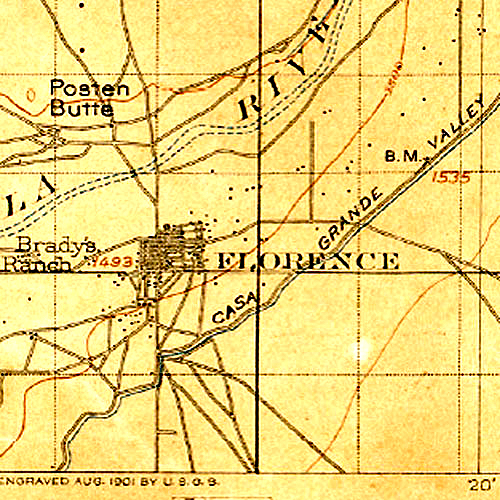
BM1493 is shown on this 1902 Florence Topographic map. If a person had access to just this map, and not the bulletin, how would he know that the benchmark was located at such an interesting place?
 |
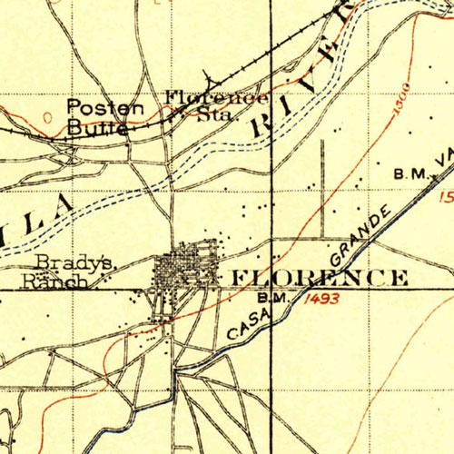
The 1902 map was revised and re-issued in 1912. Important information was added to the map, but somehow, the location of BM 1493 was transposed about 1 mile to the east of its actual location....
 |
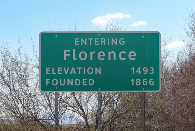
The "official' elevation for Florence as noted on this sign is the elevation of BM 1493. This makes two interesting "Entering....." signs.
 |
Gila County Courthouse at Globe:
This section of bulletin 573 shows that the benchmark that was attached to the Gila County Courthouse was the 5th in a "line" of markers that was run from a summit in the Pinal Mountains down into Globe. The elevations were referenced to the benchmark at the Maricopa County Courthouse.
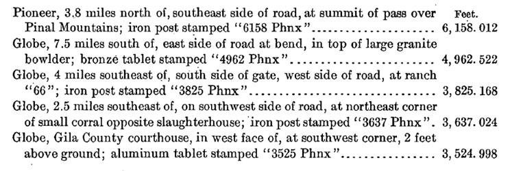 |
Benchmark 3525, at the Gila County Courthouse does not appear on this section of the Globe Quadrangle that was surveyed in 1900/1901. BM 3637, which was in the run of benchmarks with the courthouse tablet, is shown. The others, in the group, appear on the full size version of the map.
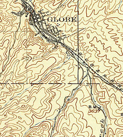 |
This is the Gila County Courthouse building that currently holds the benchmark. It was not "erected" until 1906. So, this was not the building that was referred to in the listing above.
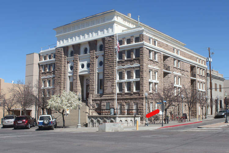 |
In 1900, the Gila County Courthouse occupied this building. It was constructed in 1888 and was demolished just before the construction began on the building shown above. In the data sheet for BM 3525, it was noted that upon the announcement that the 1888 building was to be demolished, reference marks were created so that the benchmark could be relocated onto the new building in exactly the same position.
 |
 |
This benchmark is not stamped "3525 PHNX". So, not only is the building not the original building, the benchmark is not the original benchmark. When/Why was it replaced? Does the empty hole above the benchmark have something to do with the story?
 |
This benchmark is today considered to be the "3525 RESET". According to the NGS datasheet, the move from the original courthouse to the new one was done with the approval of the USGS. The change-over happened in 1906. It seems like this would have been noted in Bulletin 573, but it was not.
National Bank @ Prescott
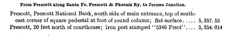
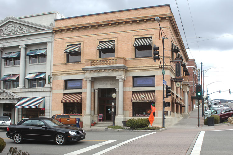
The Prescott National Bank building in Prescott was the first elevation determined in a line that was laid out along the Railway that ran from Prescott towards Jerome Junction. This was an interesting measurement in that there was no benchmark established at the location. The marker was a "flat surface". Today, the bank building is in business as a candy shop.
The second entry was located just a few hundred feet to the southwest. There, a marker was set that was stamped "5346". That benchmark would go on to serve as a reference for other benchmarks that also would be stamped "PRSCT". The courthouse referred to in this listing was torn down and replaced by the current building which opened in 1915. BM 5346, which survives, is located in the base of the Bucky O'Neill statue.
 |
 |
 |
At the northern end of the street where the bank building is located is this old Train Station. For some reason it was not benchmarked during the survey towards Jerome Junction. I wish that I knew more about the criteria that was used to decide which locations would receive the elevation benchmarks and which ones would not. In 1933, the station was "awarded" a benchmark tablet.
 |
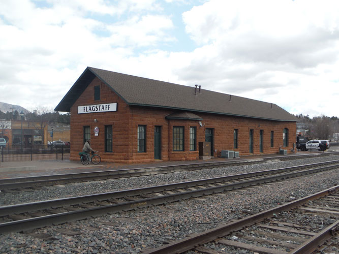
Railroad Station in Flagstaff:
The United States Coast & Geodetic Survey set out many of the benchmarks in northern Arizona, especially those that were established near the cross-country railroad line of the Atchison, Topeka, and Santa Fe Railroad Company. The Bulletin 573 entries for their stations used the Metric System to describe the locations of the markers. Apparently, this agency adopted the Metric System back in the early 1800s.
Unique to the USC&GS was the identification of their benchmarks. For this survey, which began at Topock, on the Colorado River, the first benchmark was identified as "A". As the surveyors worked their way eastward, the subsequent marks were given letter names, in order, until the entire alphabet had been used. After "Z" had been assigned, the next station was designated as "A1". The lettering sequence continued until "Z1" was established. "A2" became the name for the next station installed. This pattern of names continued until the end of the line was reached. The last benchmark was established near Lupton and its designation was "I5". The benchmark on the wall at the Flagstaff station, because of its designation of "E3" , could be identified as the 83rd station established from Topock.
 |
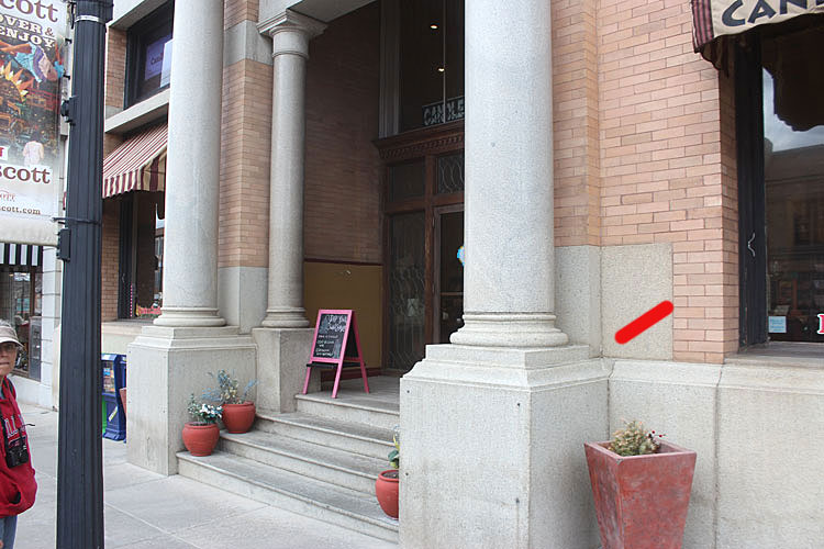
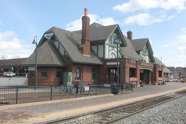
The Flagstaff station was constructed around 1886 and its benchmark was established in 1909. Today, the building may serve as offices for the railroad, which is the Burlington Northern Santa Fe Railway Company.
 |
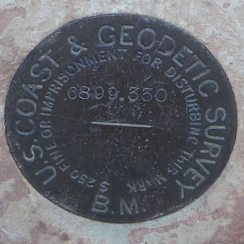
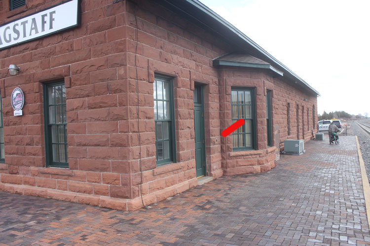 |
The USGS tablets promised a fine of $250 for "disturbing" the marks. The Geodetic tablets included the threat of "imprisonment". The elevation stamped on the benchmark differs from the elevation recorded in the bulletin by .141 feet. That is approximately 1.7 inches......
 |
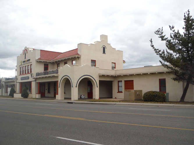
In 1926, the railroad station was replaced with this building which stands a few feet south of the old station. Today, one section of this building serves as a Visitors Center and the other is an AMTRAK Station.
 |
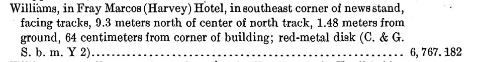
Fray Marcos Hotel in Williams:
The Fray Marcos Hotel was one of the famed Harvey Houses that was associated with the AT&SF railroad. The history of the hotel can be found here. The building opened in 1906. The benchmark was installed in 1909. Today, the building serves as the Ticketing Office and Gift Shop for the Grand Canyon Railway Company.
 |
 |
The old newstand, in fairly modern times, may have served as a counter for a Starbucks.......
 |
The C&GS disks seem to have a different surface texture and appearance from the USGS markers. Do they have a different composition? There are several copper alloys that can be labeled as "red-metal".
 |
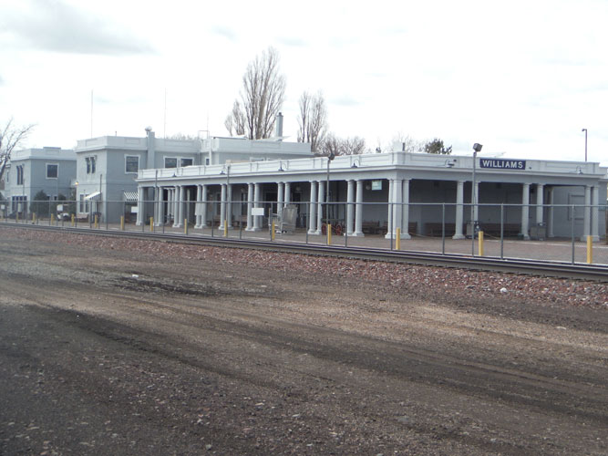
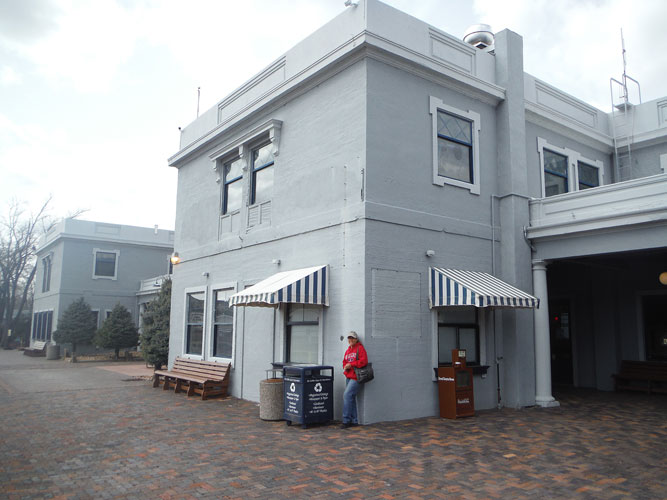
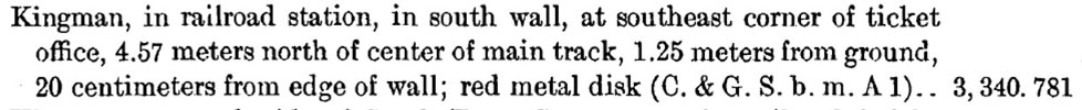
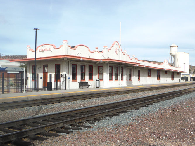
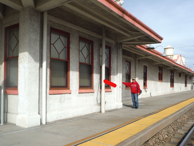
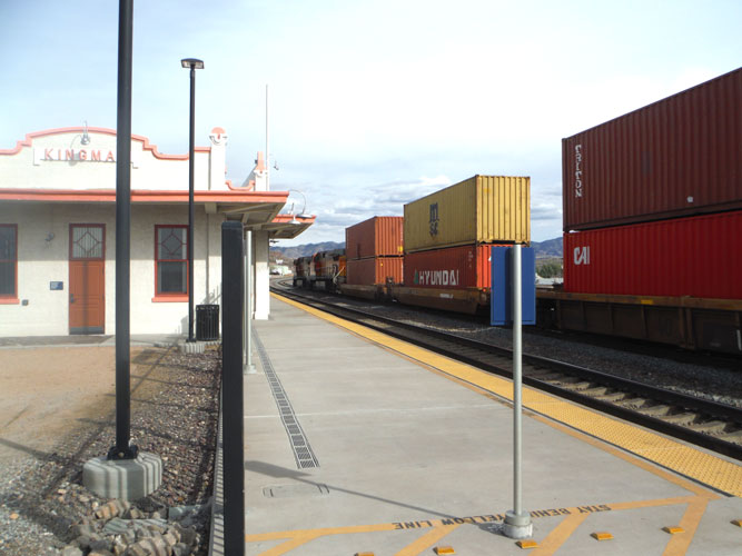
Railroad Station in Kingman:
This railroad station was built in 1907. The benchmark was established in 1909. In the early days, there was a Harvey Restaurant nearby. From the designation "A1", this was the location of the 27th survey station east of Topock.
 |
The building was restored in 2011. Today, the east end of the building houses a railroad museum and the west end is an AMTRAK station. The road, on the other side of the building, is historic Route 66, now known as the Andy Devine Highway.
 |
 |
 |
One has to be careful around the old railroad stations in northern Arizona. The tracks are still very active.....
 |
This hunt for the old buildings with benchmarks had been a great adventure! I have found "benchmarking" to be so interesting! The next hunt is being forumlated......