 |
The Old Florence-Riverside/Kelvin Wagon Road
|
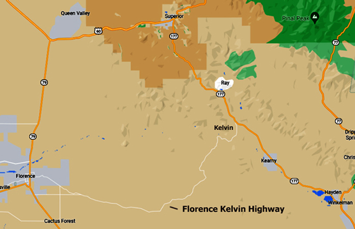
The original Florence to Riverside/Kelvin Road was constructed in the 1870s as the first segment of a wagon road that connected Florence to Globe. For several decades the road was busy with stagecoach and horse drawn wagon traffic. Today, a scenic backcountry road with a similar name, Florence-Kelvin Highway, connects Highway 79 south of Florence to Highway 177 north of Kelvin. I was curious about the relationship of the old road to this new highway. What I have learned is that the current highway follows the route of a road that was constructed in the years 1915 to 1918 to replace the original road. The replacement road, over most of its length, was located several miles away from the wagon road. This report is about the current status of the original road.
A screenshot from Google Maps shows the current Florence-Kelvin Highway. The road is paved for approximately half of its 32 mile length. It provides a shortcut for travel from Kearny, Hayden and Winkelman to Florence.
 |
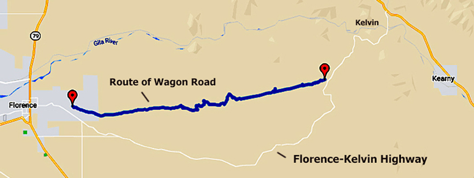
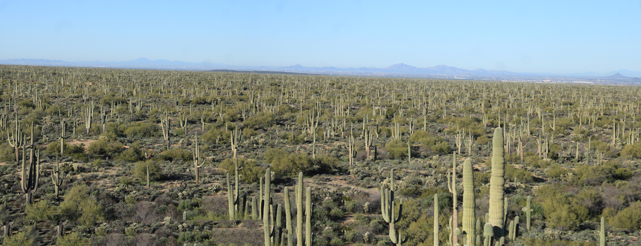
The route of a section of the original wagon road is represented below. GPS readings from different locations along the roadway were put together to show its path. The wagon road continued beyond the gps markers. Views of both the Florence and Kelvin ends of the old road can be seen in Google Earth images that are available later in the report. There are approximately 20 miles of the old road represented by this gps track.
 |
A brief history of the early Florence to Kelvin road:
In the late 1870s, a wagon road was constructed to connect Florence to Globe. Before the building of the new road from Florence, access to Globe was over a road that originated in Willcox. Businessmen in southern Arizona wanted a more direct route.
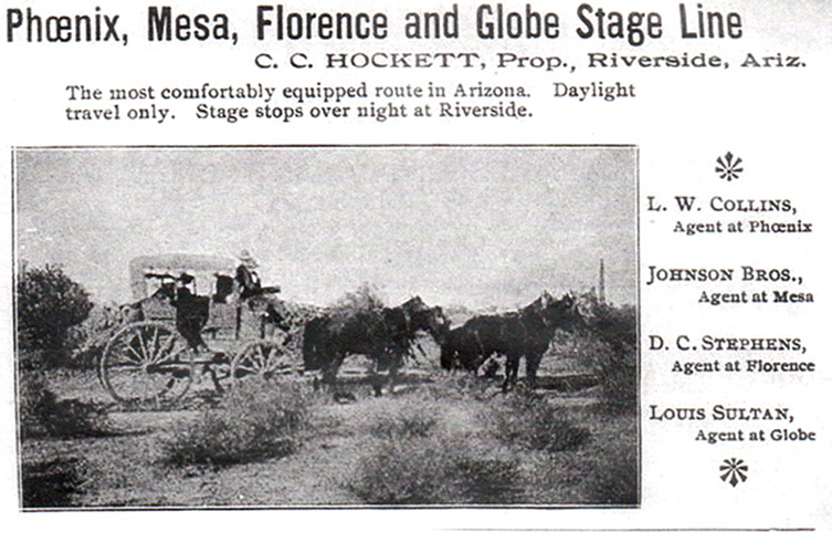
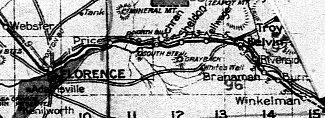
For stagecoaches, the first segment, or stage, of the trip from Florence to Globe was a 30 mile run to a stage station in Riverside. Riverside was located on the southside of the Gila River near its junction with Mineral Creek. This section of the road was identified as "The Florence to Riverside Wagon Road". It was also known as the Florence-Riverside Road.
Equipment used by one of the stage companies is shown in this advertisement. The company thought it was worthwhile to note that they traveled the route only in daylight hours. Other stage companies ran the road at night. Their coaches were equipped with acetylene lamps.
 |
In 1899, the stage station in Riverside was relocated to Kelvin, a new community which had been established on the northside of the river. This resulted in a name change for the road. It became "The Florence to Kelvin Wagon Road", or more simply, the Florence-Kelvin Road.
A map that was drawn in the early 1900s showed the routing of the wagon road between Florence and Kelvin. South Butte, Grayback, and White's Well, landmarks near the road, were identified.
 |
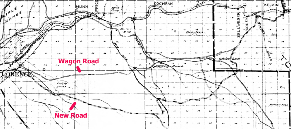
Between the years 1915 and 1918, a new "Gravel Surfaced Road" was constructed to replace the wagon road. A Pinal County map issued in 1919, showed both the original wagon road and the new replacement road. The new road, for the most part, was located several miles south of the wagon road. Near Kelvin, the two roadbeds remained separate, but were close to one another.
The current Florence-Kelvin Highway follows the route of the replacement road not the original wagon road. So its history does not date back to the days when stagecoaches and wagons ran between Florence and Kelvin.
 |
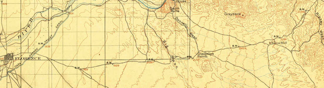
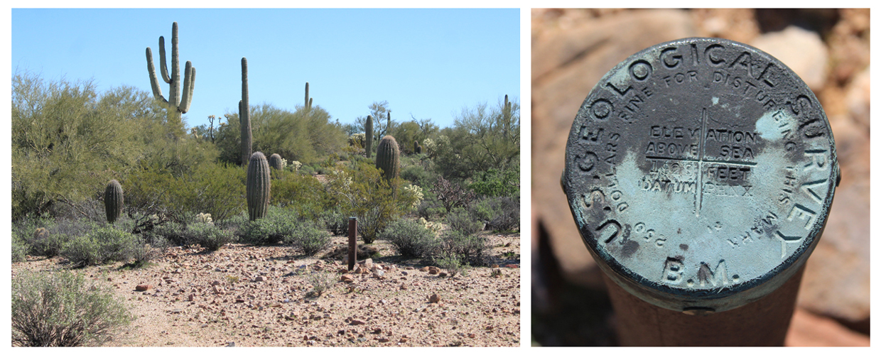
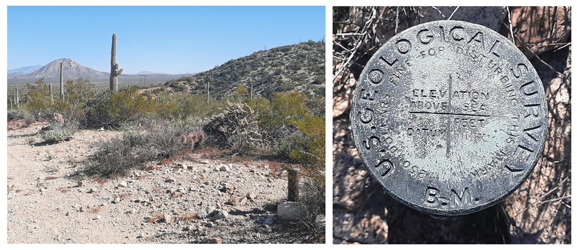
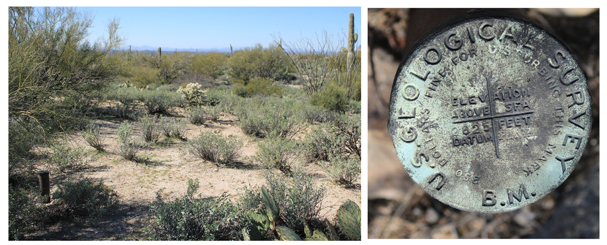
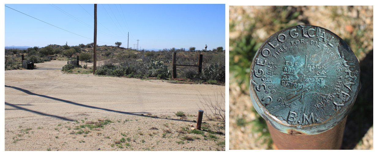
The earliest maps that accurately identified the route of the wagon road were the USGS Florence Quadrangle published in 1902 and the USGS Ray Quadrangle published in 1910. This section of the 1902 Florence map shows the first 25 miles of the road east from Florence. The area had been surveyed in 1900. As the survey work was done, 7 USGS benchmarks were installed along the road to mark its route. As I explored the route of the old roadway I was able to locate 6 of the 7 benchmarks.
 |
A friend who was interested in events that had occurred on sections of the wagon road north of Kelvin took on the project to overlay the 1902 Florence map onto Google Earth images of the Florence-Kelvin area. This link leads to his overlay: Overlay. His project provided the insight where to begin the search for the original road between Florence and Kelvin.
The Wagon Road from near Florence to Big Wash(Box O Wash):
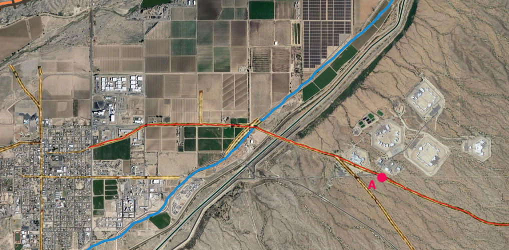
The first of the explorations began at the Florence end of the wagon road. Point "A" was the starting point. From that point eastward, the old wagon road is on Arizona State Trust Lands and BLM public lands. If there is any private land, it is not posted against entry.
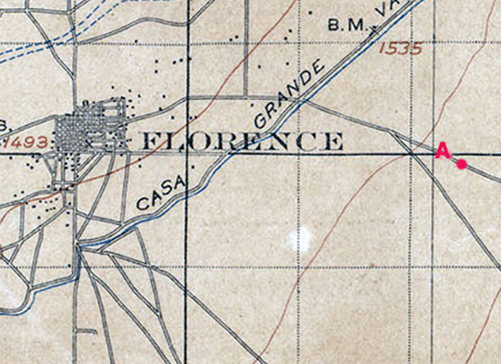 |
This section of the wagon road overlay illustrates why the search for the wagon road did not start closer to Florence. The first few miles no longer exist. They have been erased by land development in the area.
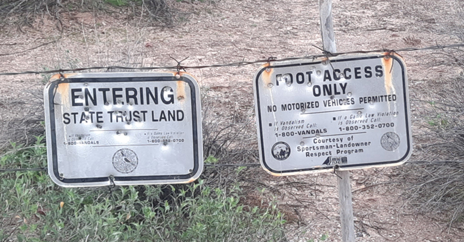
The building complex north of point A is affiliated with the Arizona State Prison System. No entry is permitted into any of that area. I do not know the reasoning, but the sections of State Trust Land near point A are restricted to foot access only, no motorized vehicles are permitted. There are signs posted with that information.
 |
 |
It was not always easy to spot the road from ground level. The real key to being able to locate and then follow the road was having the appropriate map loaded into the Avenza mapping program on my phone.
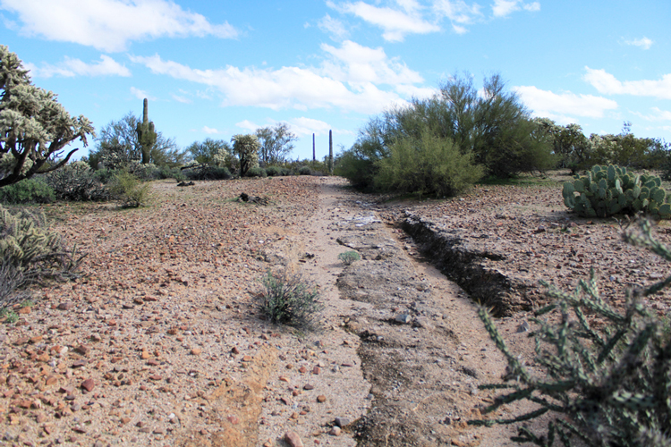
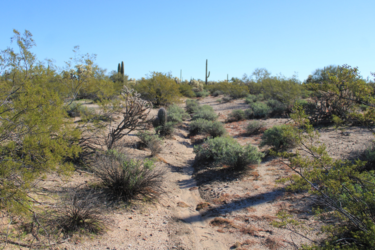
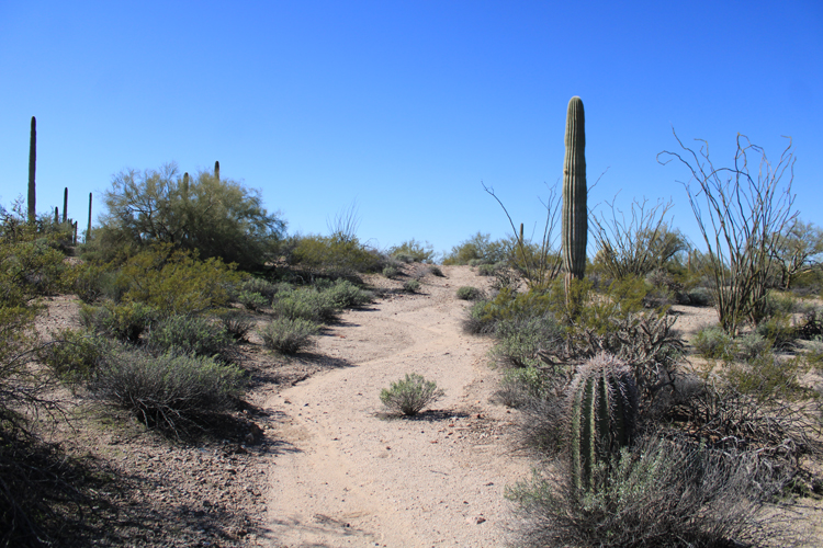
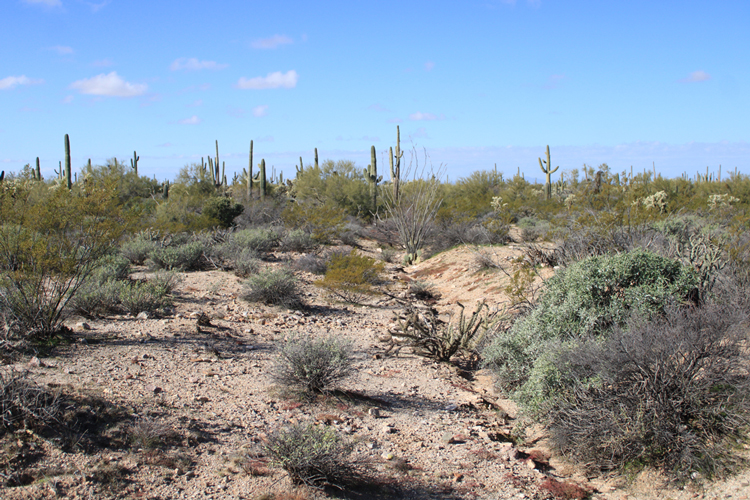
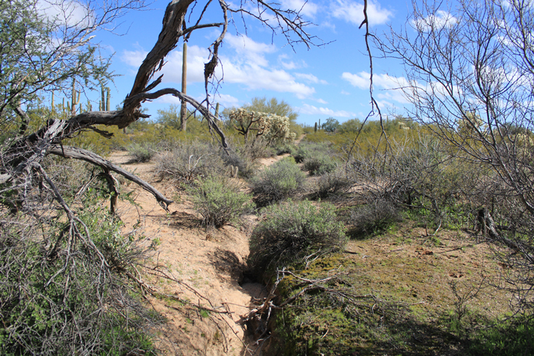
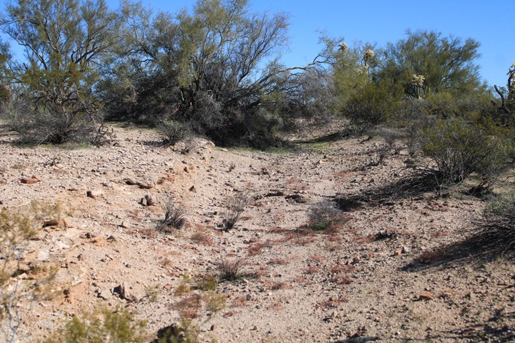
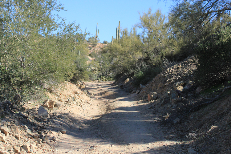
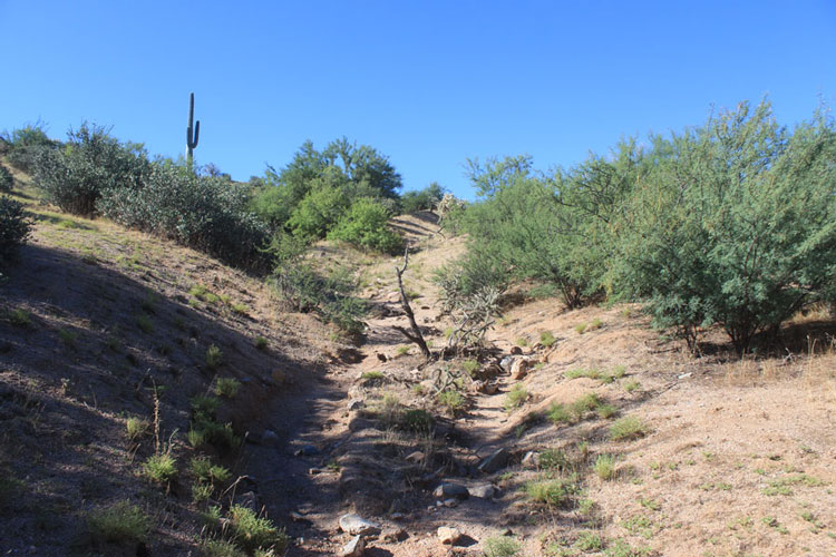
A long section of the old road east of Florence shows no signs of modern vehicle travel. These photos are from along that section of the road. It is pretty interesting to know that this was once THE road to Globe for stagecoaches and horse drawn wagons!
 |
 |
 |
 |
 |
 |
Commercial usage of the road decreased dramatically after 1904 when a railroad line constructed from the Phoenix area arrived at Kelvin. Mail, freight and passengers switched from travel by wagon or stagecoach to travel by train.
Discarded Items seen along the way:
Very little trash from recent times was seen along the road. There were a few modern pull top beer cans and plastic shotgun shells. Most of the litter appeared to be fairly old. Did any actually date back to the days when there were wagons on the road? I do not know that answer, but it was fun to imagine that some of the items could......
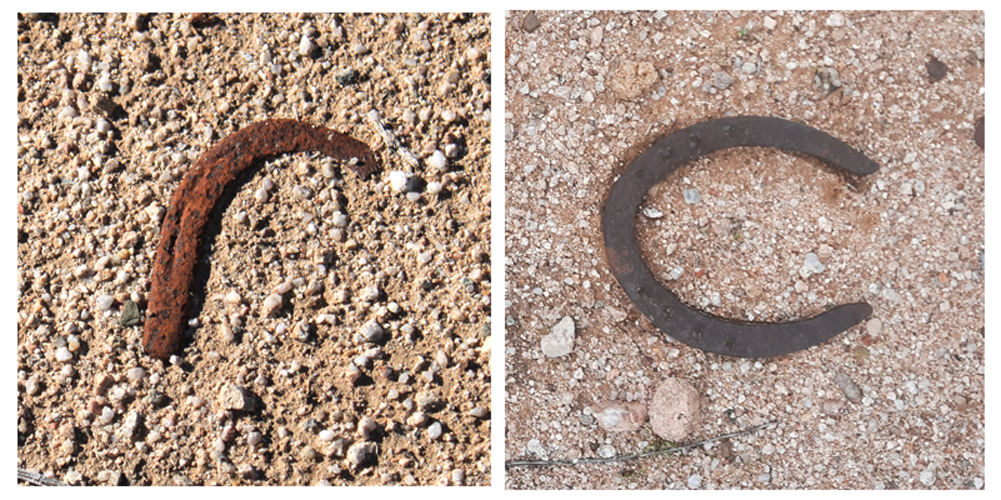
Discarded horseshoes were probably the most common of the relics that I saw. There were many broken ones.
 |
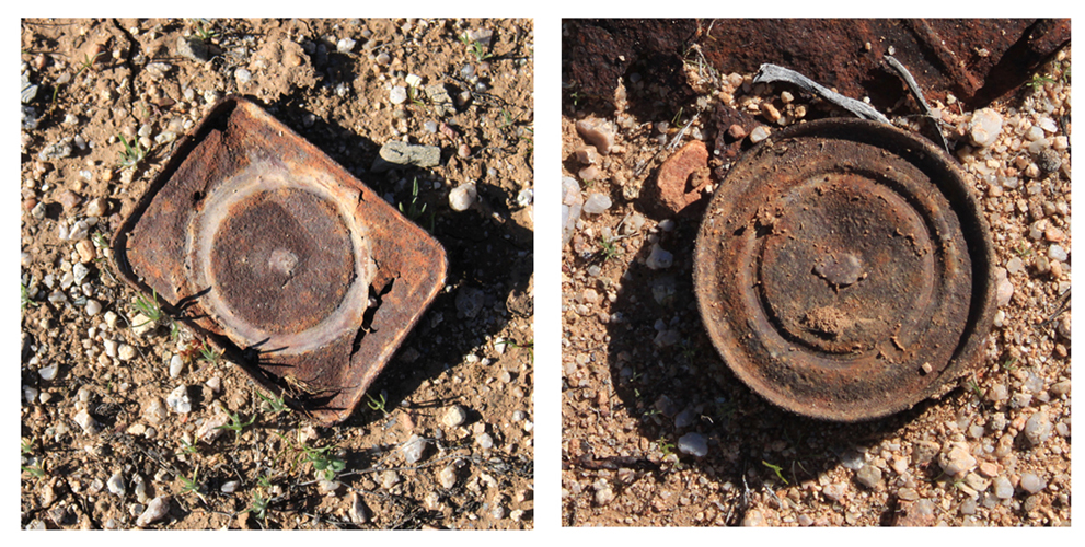
Many rusty cans were seen. These were examples of "Hole in Top" manufacture. Food was inserted into the cans through the large holes in the tops. The cap, which had a small vent hole, was then soldered into place and the food was cooked. Steam escaped through the vent hole during the cooking process. Afterwards, the small vent hole was soldered to seal the can. This process was used from the 1820s until WWI.
 |
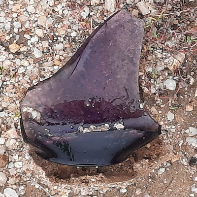
There were quite a few pieces of broken glass seen along the way. Many had the purple color of "Desert Glass". This is the old glass that turns color if it has sit out in the sun for many years.
 |
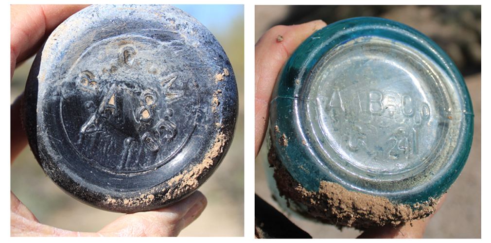
Some of the broken bottles had interesting markings. The bottle with the marking "A.B.G.M.C0" was apparently manufactured by the Adolphus Busch Glass Manufacturing Company". This company made many of the beer bottles used in the late 1800s/early 1900s by Annheuser Busch.
The bottle with the marking "A. B. Co" may have been manufactured by the American Bottle Company which was in operation in the early 1900s.
 |
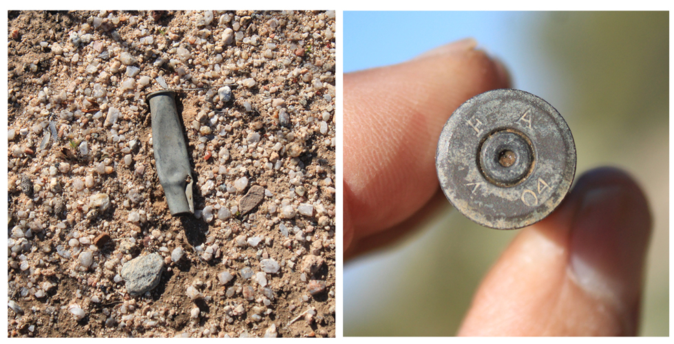
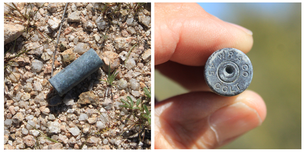
It was very exciting to come across several empty ammunition cases along the old road. The headstamp on this case indicated that the round was produced in April of 1904 by the Frankford Arsenal. Frankford Arsenal, a U.S. Army ammunition manufacturer was located in Philadelphia Pennsylvania. The length, rim diameter and the case diameter of the shell suggested that this relic was chambered for the 30-40 Krag. This was the Army's first rifle that was not a black powder powered weapon. There is no way to know the actual history of this shell. The 30-40 Krag rifles were in popular use by civilians after the military moved on to other weapons.
 |
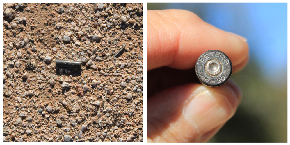
This 32-20 case was manufactured by the Peters Cartridge Company. Originating with Winchester in the 1880s, the 32-20 caliber was a black powder round. Peters began their manufacture of shells for this caliber in the 1890s. The company went out of business in the early 1930s. When I first saw this shell, I thought that I was looking at a pistol round. Apparently, this caliber was originally brought to market as a rifle round. Colt, at some point in time, did chamber several of their revolvers to shoot these.
 |
The Benchmarks from Florence to Big Wash(Box O Wash):
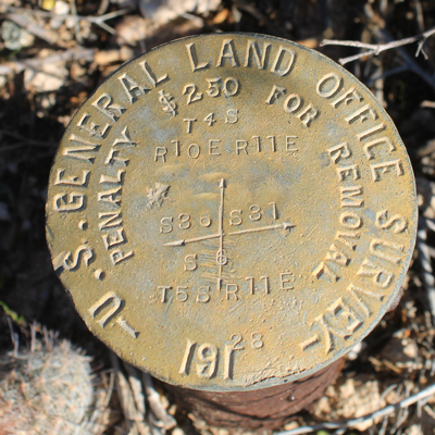
The three USGS benchmarks that were identified along the road between Florence and Big Wash on the 1902 map were all found. Their presence pretty much confirmed that the roadway was indeed the old wagon road.
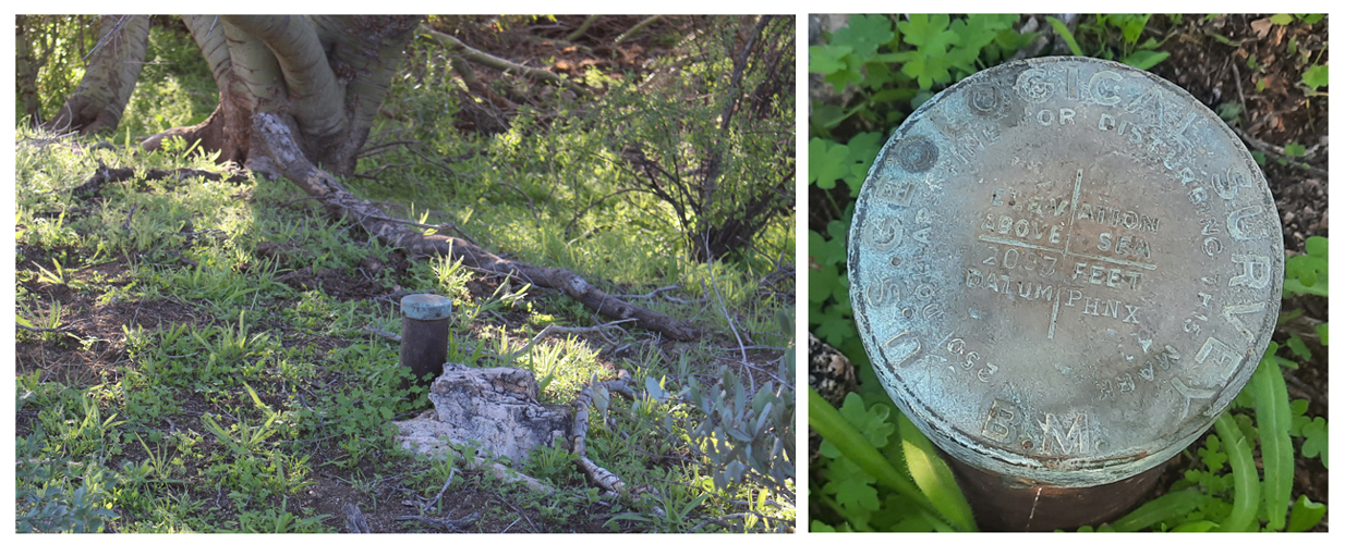
The benchmarks had been installed in 1900 and were described in USGS Bulletin 185 published in 1901. In the bulletin, these benchmarks were listed from west to east, the opposite direction that I was traveling. That meant that the first one that was encountered was at the bottom of the list. It was Benchmark 1769. In the days before gps, the locations of benchmarks were referred to places near by.
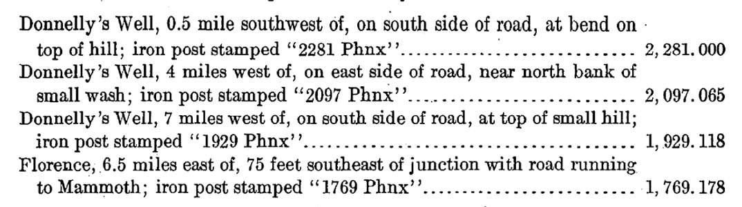 |
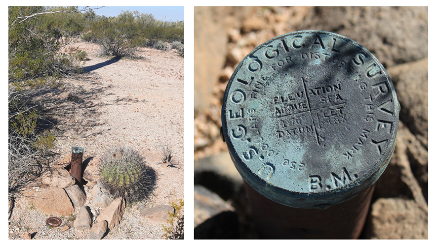
The iron post of benchmark 1769 is to the left. It has been here in the desert for 123 years. Established by the United States Geological Survey. the marker was stamped "1769 PHNX". The letters "PHNX" meant that the elevation measurement here at BM1769 had been determined from the known elevation of a benchmark in Phoenix. The reference disk in Phoenix was the one mounted in a wall of the original Maricopa County Courthouse.
An interesting note in the listing for this benchmark is that it was located near the junction with a road that ran to Mammoth.
 |
BM 1929 is located approximately 2 miles east of benchmark 1769. As described, the stamps on this BM read "1929 PHNX". The benchmark's location was referred to "Donnelly's Well". The well(ranch) is/was on the wagon road east of Big Wash(Big O Wash).
 |
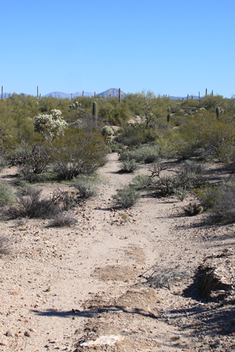
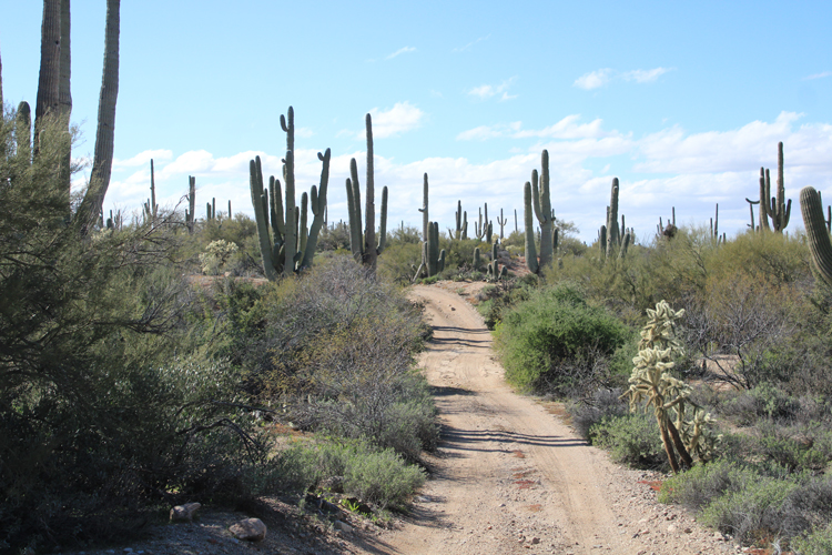
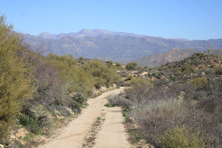
East of Whitlow Ranch Road, the bed of the old wagon road has been taken over by Jeep and other OHV traffic. The jeep trail did not always coincide exactly to the location of the old road, but it was close.
 |
Once again, when you are at one of the benchmarks, there is little doubt that you are on the old road. That was the case at Benchmark 2097, which is located approximately 3 miles east of BM 1929. At this location, the jeep trail had turned in a slightly different direction from that of the wagon road. As described in the USGS bulletin, this benchmark was located near a small wash. The wash was the roadbed. The modern version of the road has bypassed this section of the old road.
 |
 |
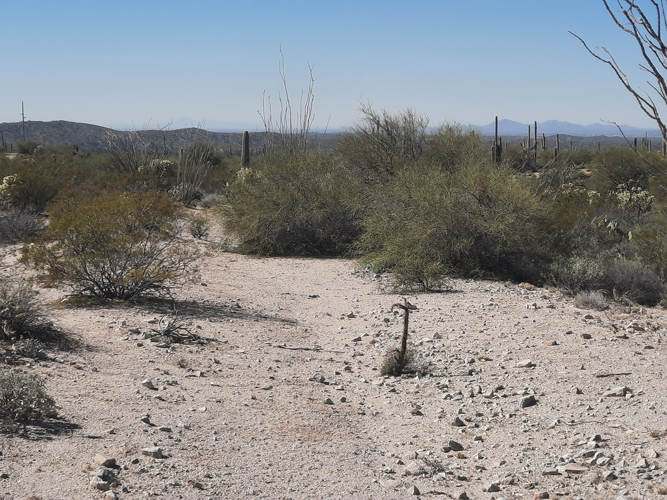
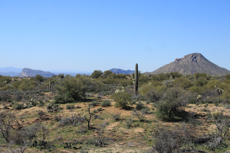
On the 1902 Florence map, approximately 3/4 of a mile east of BM2097, the symbol for a small hill is shown on the north side of the old road. This photo was taken from the top of that hill, with the camera pointed west towards Florence. It provides a view of what the terrain was like that the wagon road had crossed on its run from Florence.
Out there in the desert, there are very few intrusions onto the actual roadbed of the old wagon road. There is one powerline, one graded road, and a few jeep trails that cross over the old route. There are no signs of modern vehicle traffic on many miles of the old road.
 |
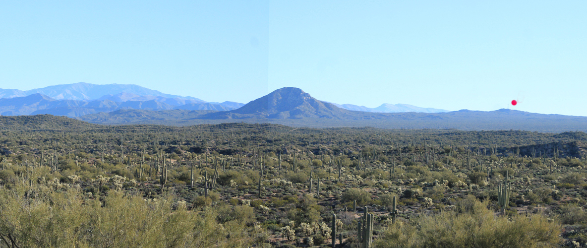
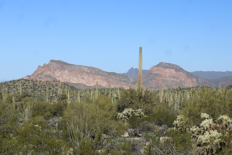
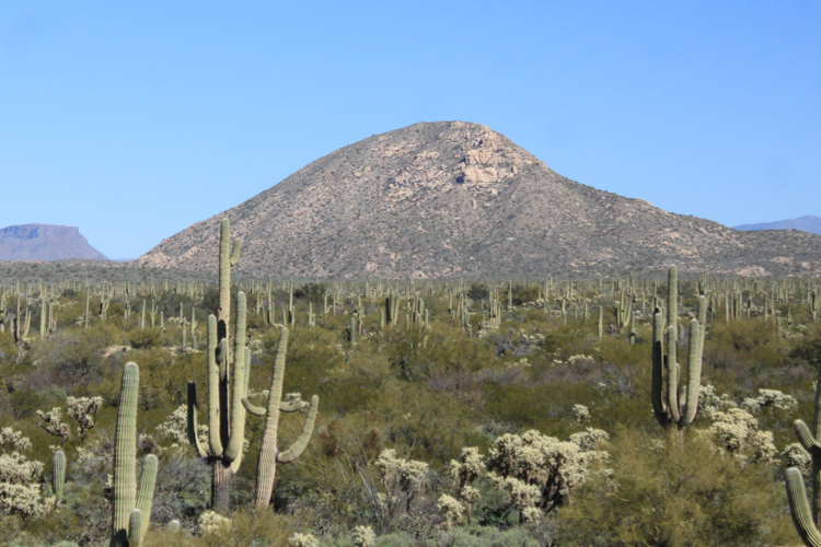
This was the vew from the hill facing east towards Box O Wash and points beyond. The right to left shadow across the lower third of the photo was the rim of Big Wash(Box O Wash) Canyon. The large solitary peak beyond the wash is Grayback. It is one of the landmarks that was identified near the wagon road on the early maps. At the dot on the skyline, the wagon road reached its highest elevation in the run from Florence to Kelvin. From there, it was downhill the few remaining miles to the town.
 |
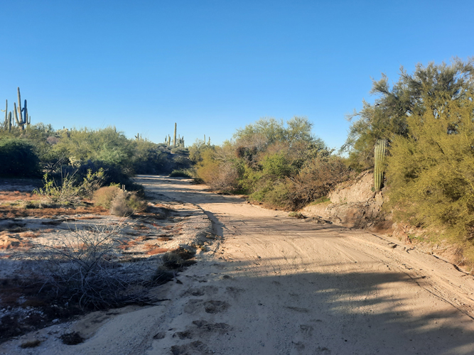
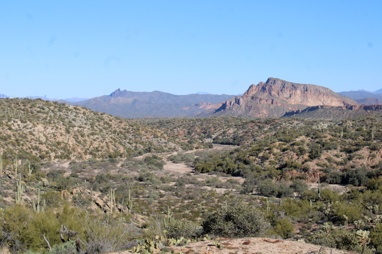
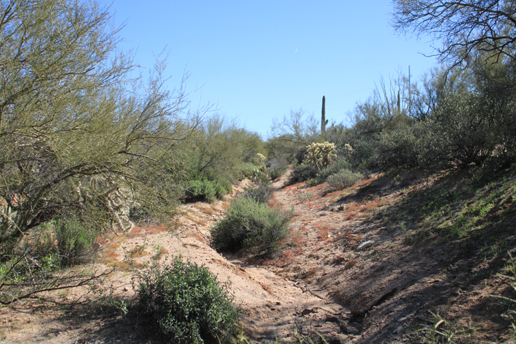
Crossing Big Wash(Box O Wash) would have been the first challenge for wagons and stagecoaches traveling from Florence. This view of the wash is north towards the Gila River. South Butte is the prominent peak. The old wagon road dropped into the wash near here and climbed up an equally steep slope on the other side.
 |
The wagon road from Big Wash(Box O Wash) to the Towers Road:
On my way down into the wash, I looked to see if I could spot the original route. No luck there. Maybe it was under the road that I was on. There is a powerline very near this location. The construction of the roads for its installation and servicing may have erased the old wagon road.
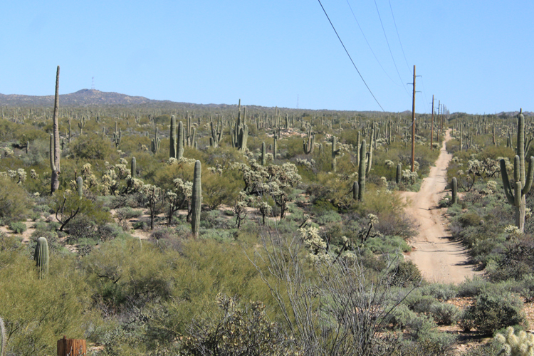
Eastward from here it was challenging to locate the old wagon road. There are now many roads in the area that cross over or run along the route of the old road. Two powerlines appear to have been constructed very close to the track of the wagon road and follow where it should be for miles.
 |
The exit from the wash for the wagon road was supposed to be near here. Today's version of the road took some energy(low gears and 4wd) to navigate. I wish that I could have spotted the old road to see what it had been like, but I did not.
 |
This benchmark was seen alongside the road that paralleled the high voltage power line east of Big Wash(Box O Wash). It is not one of the markers that was installed in 1900. The BLM map that shows the location indicated on the marker was drawn in 1892. It showed the Florence to Riverside road to be just north of this location.
 |
Traveling east from Box O Wash a bit further along on the way to BM 2281, this was the view to the northwest. South Butte, which had been visible for pretty much the whole distance from Florence, was no longer obscuring the view of its partner North Butte. North Butte is on the north side of the Gila River. In 1899, survey work was done at the Buttes to see if a large dam could be built there. That did not happen. Coolidge Dam was built at San Carlos..
 |
This powerline and the roads associated with it may have taken the place of the old wagon road.
 |
This is the iron post and the disk of BM 2281, another one of the markers installed along the wagon road in 1900. Grayback Mountain is in the distance. This marker was at the top in the listing of the benchmarks previously presented. Its location was described as being located 0.5 miles southwest from Donnelly's Well. The well/ranch site is just a short distance off this point of land.
With so many roads crisscrossing nearby to confuse the issue, the presence of this benchmark pretty much certifies that this piece of road was once part of the old wagon road.
 |
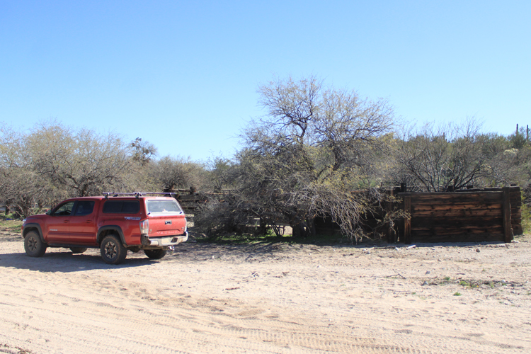
Donnelly's Ranch was identified on the 1902 map. The location is still in use. Corrals and a water tank are located here. One of the busiest backcountry roads in the area, the Cochran Road is close by.
 |
Donnelly's Well was the reference point for several of the next benchmarks that were along the Florence and Riverside Road. Where the previously established markers had been described from east to west, these were described from west to east.
 |
Headed east from Donnelly's Ranch I spotted this abandoned road segment that ran up to a ridge line out of Donnelly's Wash. If it was not a part of the wagon road, it is very close to where the road had been.
 |
The wagon road was supposed to have been close by. No signs of it were spotted.
 |
The iron post of BM 2625 is standing in the shade. This marker was perhaps 50-100 yards north of the powerline road.
 |
Near the benchmark, a short section of the wagon road was found running parallel to the powerline. However, it did not continue very far in either direction before being cut off by the powerline.
 |
An empty cartridge case was found along this section of the road. The Winchester Repeating Arms Company was the manufacturer of this 45 colt caliber shell. Apparently, the "W R A Co" lettering was used on Winchester shells manufactured from the 1860s to 1928. This round was associated with the "Colt 45", a pistol favored by the early cowboys of the Southwest.
 |
Grayback Mountain. Early travelers may have used the change in the appearance of this landmark as a gauge to measure how far they had come and how far they had to go.
 |
A few miles further east, the iron post of Benchmark 3081 stands in a well traveled place. The location notice from the USGS Bulletin stated that this was the highest point on the wagon road between Florence and Riverside. The road in the distance may have covered the original road that connected to Florence. The disk is showing quite a bit of wear....
 |
The was the view west towards the Buttes from near the high point on the old road. Only the tops of those peaks were visible.
 |
The Wagon Road from the Towers to Kelvin:
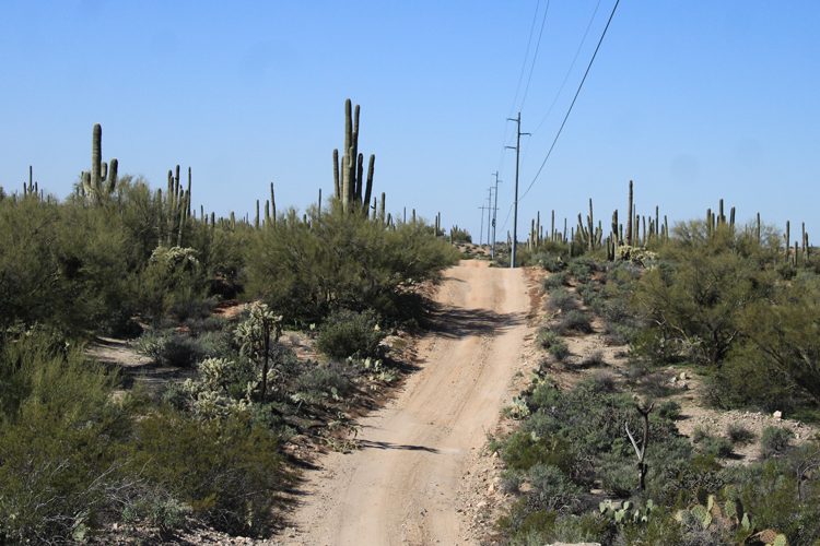
A service road now occupies the route of the wagon road down off the high point of BM3081 to the northeast. The Gila River Valley is in the distance. Near the bottom of the hill, the new Florence-Kelvin Highway passes near the route of the old wagon road.
That is the location on the current road east from Florence, where travelers can spot the remains of the old wagon road for the first time.
 |
Over the next few miles to Kelvin, the paths of the old wagon road and the current road cross over one another several times. They are never far apart. One notable section of the old wagon route is the location where in 1889, the Apache Kid and several other Apaches escaped while they were being transported to the Yuma Prison. This is that section of the old road. My report on the escape can be found here.
 |
The final approach of the current road to the Gila River at Kelvin is very different from the days of the stagecoaches. The original road traveled down a wash that met the river downstream from Mineral Creek. It then made its way upstream along the river to Riverside and Kelvin. In 1916, a bridge was constructed across the river directly south of Kelvin. The new road from Florence was routed to that bridge crossing. Today, there is a brand new and very large bridge located there.
This image from Google Earth shows the current road and the location where the wagon road used to be.
 |