|
Dayhike on
the Lucky Strike Mine Trail
Sierra Ancha Mountains, Arizona
|
Topo maps of the Sierra Ancha Mountains in central Arizona, show an area of mining activity east of Center Mountain just below the southern rim of the Cherry Creek Drainage . There are several adits, a spring and a building depicted. The website Mindat identifies two mines--the Pueblo Mine and the Lucky Strike Mine. According to the website, the minerals associated with the area were magnetite and chrysotile asbestos. There is no indication of any production from the area. but I thought that there was enough shown to plan on a visit. If nothing else, it would be new country for me.
It looked like I could use a pack trail to access the mines. This trail connects the Reynolds Creek Road off the Young Highway to the Cherry Creek Road deep down in Cherry Creek Canyon. I made plans to dayhike down to the mines and back from the Reynolds Creek road the next time that I was in the area. It would be a steep hike with a round trip distance of 4-5 miles.
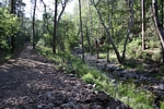
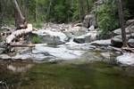
I had been in the Sierra Ancha area many times, but had never driven the Reynolds Creek Road. It is a primitive road. On the day that I was there in May the creek was running nicely. 4wd was not required but it could have been. There were bouldery sections where side drainages had washed debris across the road. A high clearance vehicle was certainly necessary. A couple of miles up Reynolds Creek, a left fork was taken past Cienega Spring. The road continued to climb for a couple of miles ending at a turn-around. The pack trail that I was going to use from the turn-around was not what I had expected. At sometime in the past the trail had been improved to a road. But a sign on a Forest Service kiosk at the turn-around stated that the old road is now the Lucky Strike Hiking Trail; it is in a wilderness area and all mechanized vehicles are prohibited from the turn-around onward. The FS sign described the trail as "Most Difficult" and its use status as "Light".
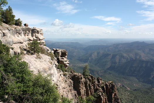
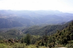
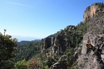
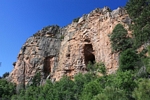
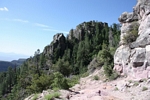
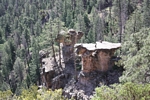
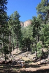
A few steps out from the turn-around there is a tremendous view of the Cherry Creek Drainage. It is a long way out and down! One can see for many miles to the north, east and south. This is a great viewpoint. The trail climbs upward from the turn-around for a half mile or so. Tall cliffs on the right were as impressive as the drops down into Cherry Creek were to the left. Then the trail/road turned downward! Other than the steepness, the going was not difficult. There were a couple of downed trees, but no major difficulties.
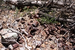
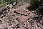
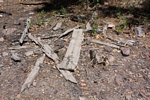
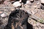
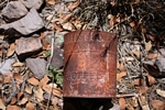
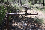
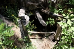
In a couple of miles, I reached the location of the mined area. There was not much to see there. It had been evident for a mile or so that there had been a fire in the area. I spotted several pieces of sheet metal and lumber, but no cabin. Had the building burned in a/the fire? There was a can dump, but no signs of mining activity. The most interesting artifact was an old water line that led back to the spring shown on the map. On the map the adits appeared to be on past the spring. I located an old trail, but it was so overgrown that I couldn't get through. I still had the climb back to the truck and a long drive back to Tucson that day, so I had to give the adventure up. Even though the destination had been disappointing in that I am always hoping to see old mine machinery and related relics, the scenery along the way had more than made the trip worthwhile!
Click on photos to enlarge:
 |
 |
 |
 |
 |
 |
 |
 |
 |
 |
 |
|
 |
 |
 |
 |
| TRIPS |
| HOME |