 |
Bridges,
Tunnels And A Surviving Loop Of The Old
Morenci Southern Railroad In Eastern Arizona
|
The Morenci Southern Railroad was constructed by the Detroit Copper Company around 1900 to connect its mining operations near Morenci to the Arizona and New Mexico Railroad at Guthrie on the Gila River.
The narrow gauge line(36") was a bit more than 18 miles in length and remained in operation until 1922. In its heyday, it appears that the train ran passengers and freight twice daily in both directions.
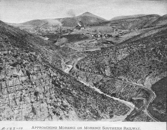 |
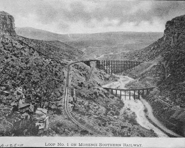
To negotiate the 1400' change in elevation between the San Francisco River and Morenci, the railroaders constructed 5 complete loops in the road bed. Four of the loops occurred in the first two miles below Morenci. Several of the loops incorporated spectacular trestles as seen in the photo below. In 1914, the trestles in three of the loops were judged to be too unstable and the loops were replaced by switchback.
The railroad had come to be nicknamed "The Corkscrew Railroad of America" from the spiraling nature of the tracks. Because of the heavy grades and tight turns, the lengths of the trains were kept to just a few cars. It was not unusual for a trip to take more than 2 hours to complete.
 |
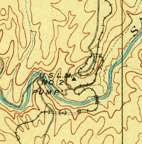
This section of the 1902 USGS Clifton Topographic Map shows the four loops that were nearest "old" Morenci.
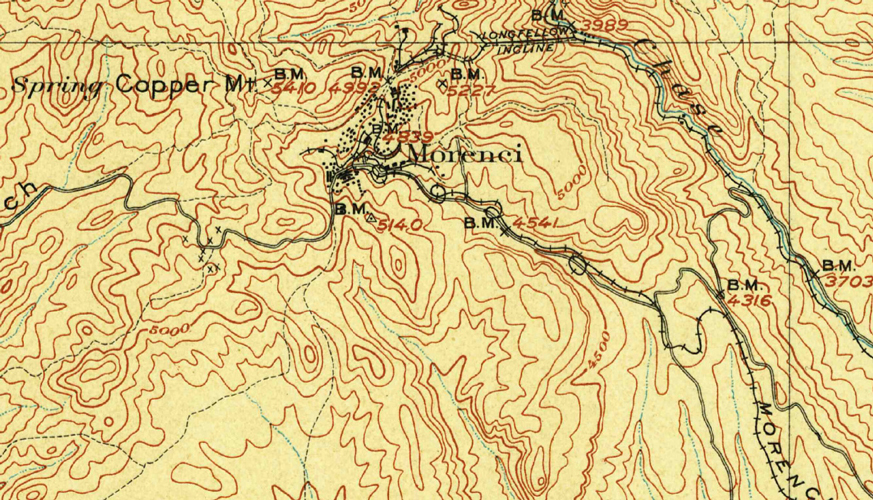 |
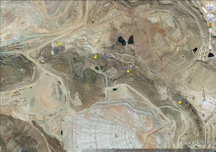
I plugged in the co-ordinates for those loops and plotted them in Google Earth. They all landed in an area of current mining operations. Any signs of that stretch of the old railroad probably disappeared long ago.
 |
This topographic section of the railroad line is a bit further south near the San Francisco River. It shows the 5th loop. In addition to the loop, with its tunnel, there was a bridge across the river and two other tunnels nearby.
For a topographic section that shows all five of the loops in one view click here.
 |
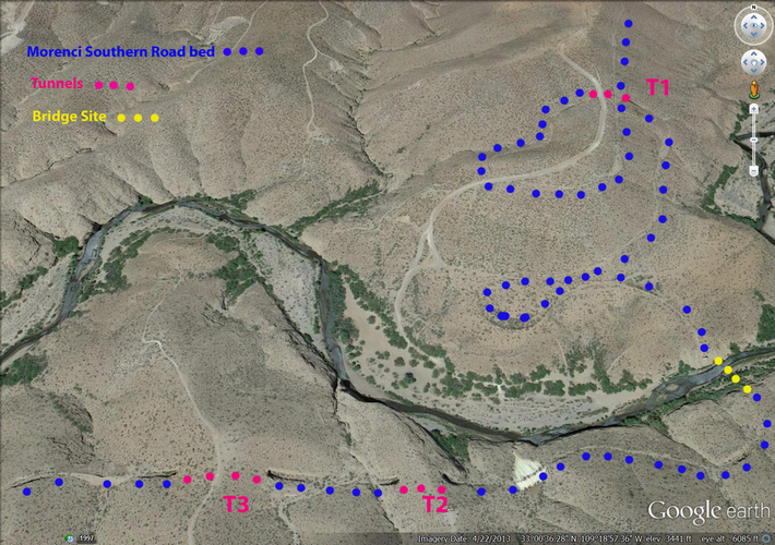
A Google Earth flyover of this area seemed to indicate that all of the structures except for the bridge across the river still existed. I extended the search to see what else might be out there by "flying" the old railroad line on towards Guthrie.
Shadows from objects on the ground in Google Earth revealed that there were three bridges still in place! A trek to the area was soon planned to check things out.
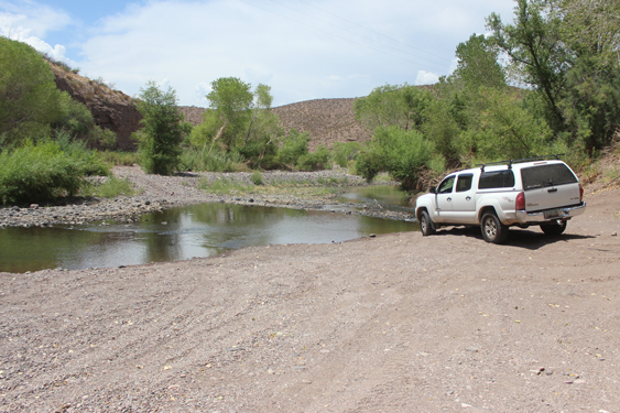
I drove to the location of the old loop near the San Francisco River for my first stop and then from there worked my way eastward. Primitive roads provided access to the old road bed at two other locations. Short hikes up and down the old right of way got me to the sites that I wanted to see.
 |
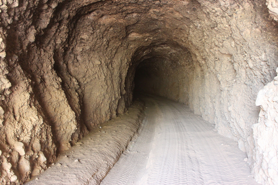
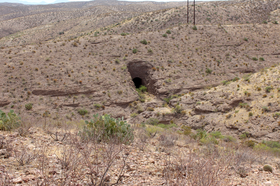
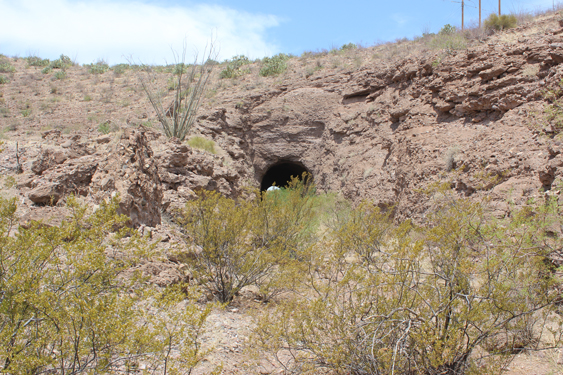
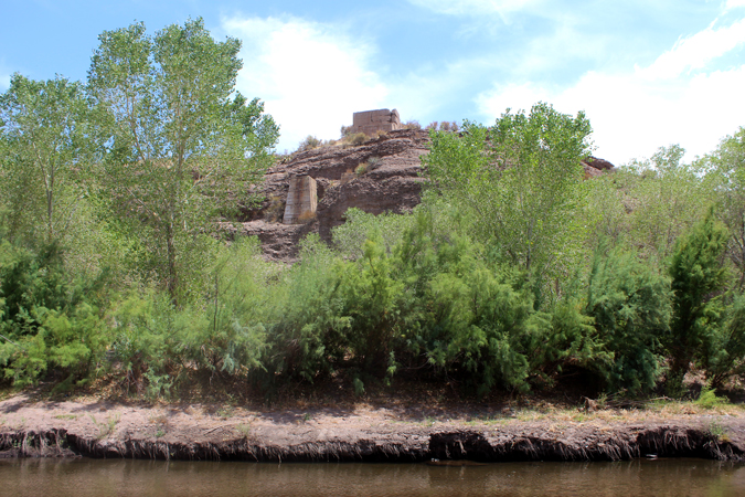
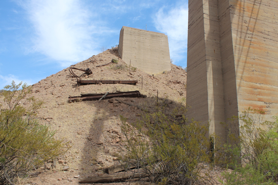
This photo is of the east side portal of Tunnel T1, the tunnel that allowed the loop to be complete. The change in the grade of the road bed can be seen in the photo. Trains traveling to Morenci would have entered the tunnel at the lower elevation, made their way around the 1/2 mile loop to cross-over the tunnel on the skyline grade.
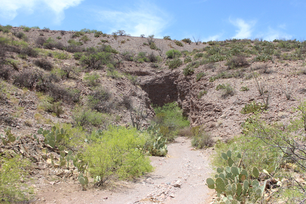 |
Tunnel T1 is over 400' long and curved. So it is pitch black inside until the turn is made. When I was here in July, there was a large colony of bats using the tunnel. ATV traffic is keeping the tunnel and a large portion of the loop in a driveable condition.
 |
 |
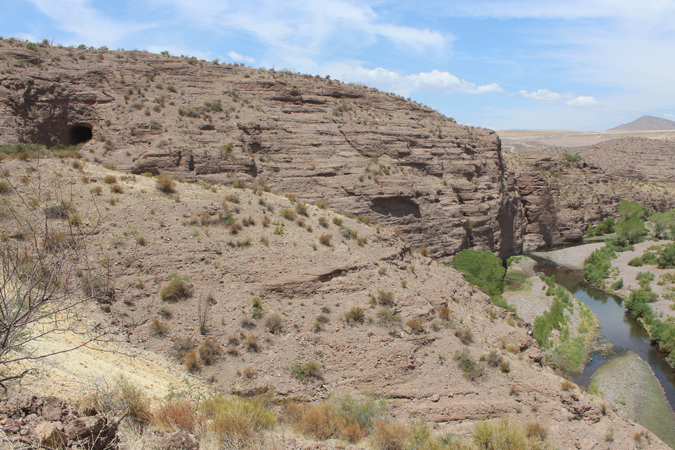
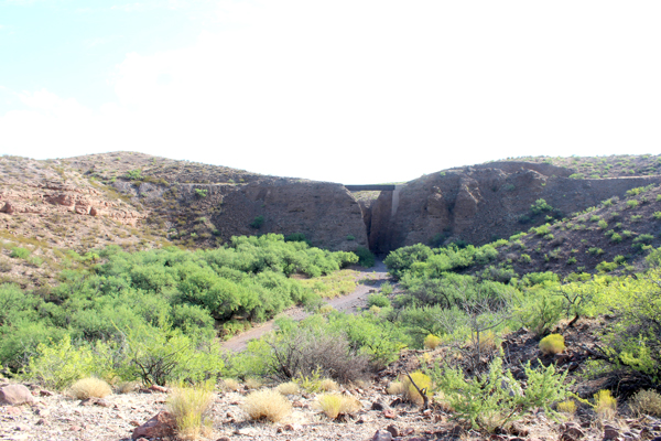
All that remains of the bridge that once crossed the San Francisco River are the concrete abutments. There is no metal debris left of the bridge. David Myrick in his volume of "Railroads of Arizona" that describes this area implies that the bridge was still standing in the mid 1980's.
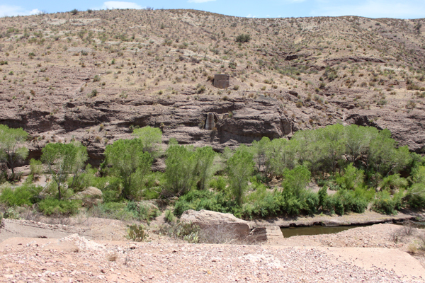 |
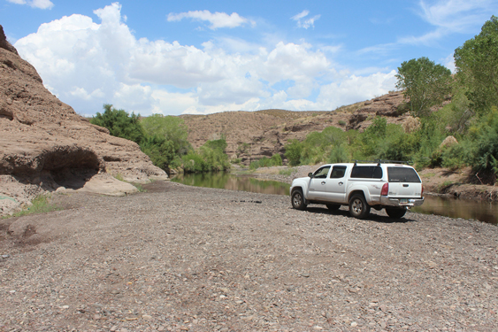
At river level just downstream from the old bridge site is a large area that is obviously used for recreation. There are mesquite trees and cottonwoods that provide shade for picnics and campouts. I forded the river to exit the canyon south on the San Francisco River Road. That road is shown in the Google Image view above passing directly over Tunnel T3.
 |
 |
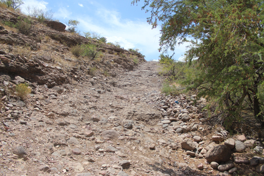
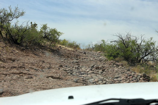
These photos are of the road climbing up out of the river. The rocky ramp shown on the left was much rougher than it appears in the photo. Once through the rocky ledge, the road surface was very loose for quite a distance. This was definitely 4WD required!
 |
 |
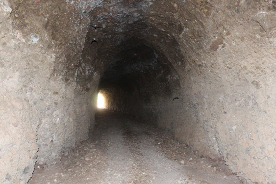
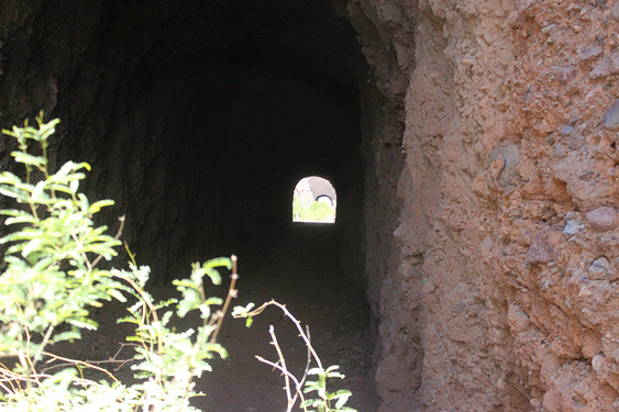
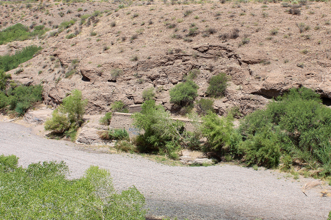
The photo on the left is the view of the west side of Tunnel T2. After a scramble down to that entrance, a turn to the right brought the eastern portal of Tunnel T3 into view.
 |
 |
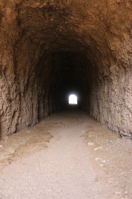
This view into Tunnel T3 reveals that after more than 100 years the structure is still very much intact with little breakdown. There does not appear to have been any re-enforcement done to the walls of the tunnel.
 |
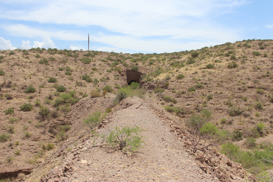
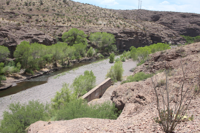
The photo on the left is the view across a long fill in the road bed looking into the west side of Tunnel T3. The small bump on the skyline to the left of the power pole is my truck on the San Francisco River Road. The photo on the right is looking eastward through Tunnels T3 and T2.
 |
 |
The materials used to make up this section of the road bed east of Tunnel T2 was not ordinary dirt and gravel. It was mined material. There were many bits of copper ore visible.
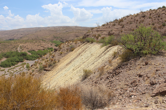 |
This is the view from the old roadbed looking west back toward the eastern portal of Tunnel T2. The bluffs of Gila Conglomerate and the San Francisco River are to the right in the photo.
 |
From the south abutments of the old "Frisco" bridge, three levels of the old railroad bed can be seen on the other side. This was the first part of the "corkscrew" up towards Morenci.
 |
Update 2016:
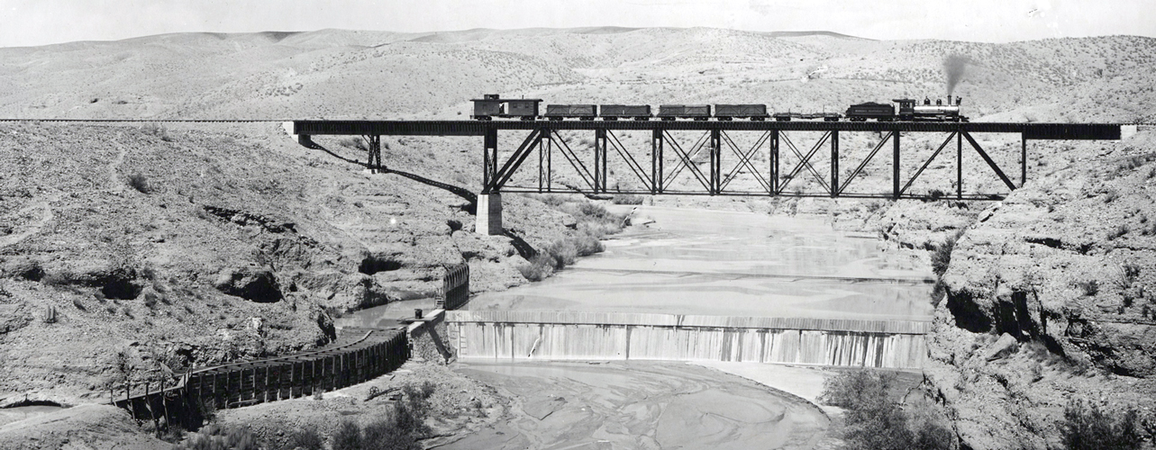
In the summer of 2016, I received an email from a fellow that included a vintage photo of a Morenci Southern train crossing the bridge over the San Francisco River. The nature of the bridge and how it was supported on the abutments can be clearly seen.
 |
It was explained to me that the purpose of the dam was to divert water into a canal that ran to a pump slightly downstream from this location. The pump then moved the water up the hill to the mining operation at Morenci. The location of that pump can be seen on the section of topo map posted above.
I went back to my photos that I had taken to see if I might have a view similar to this vintage photo. I did not. Here are several of the bridge abutments that I had not posted. This is a closer view of the northside bridge supports.
 |
This is a view of the southside bridge abutments as seen from river level.
 |
I had taken photos of the rock/concrete walls associated with the diversion canal. Since I did not know what they were about at the time of the trip report, I had not posted them.
 |
 |
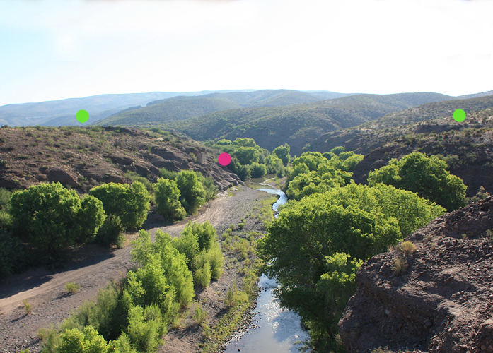
A few weeks after I received the vintage train photo, I passed through the Morenci area on my way to New Mexico. I could not pass up a side trip down to the old road bed to see if the view in the old photo could be re-created. That did not turn out very well. Unfortunately, the early morning sun was in the direction that was needed to shoot the photo....
It is difficult to see the bridge ruins. The leaves on the trees also block the view of the old diversion canal. I have marked the approaches to the old bridge with the green dots. One of the concrete abutments is visible at the red dot. I will have to try this again......
Today, there is no evidence that there ever was a diversion dam.
 |
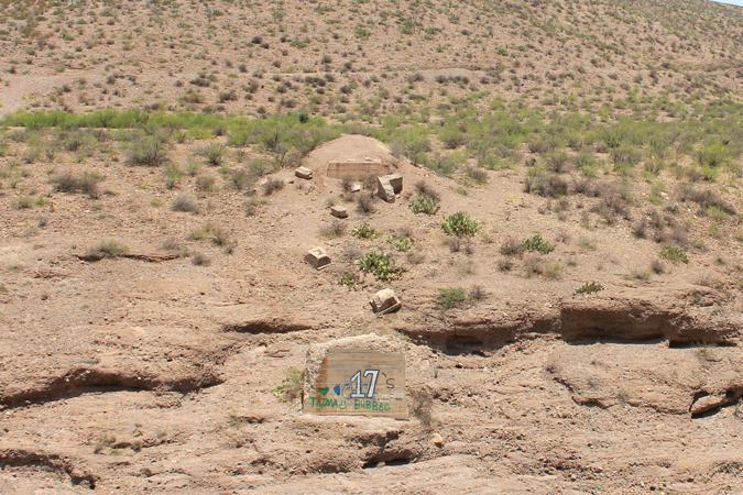
Once away from the river, there are several ways to make your way eastward. One is the official route of the San Francisco River Road which ends at the Black Hills BackCountry Byway and the sign seen below. It is also possible to drive along the power lines. That road, however, has several stretches that may require 4WD.
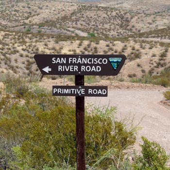 |
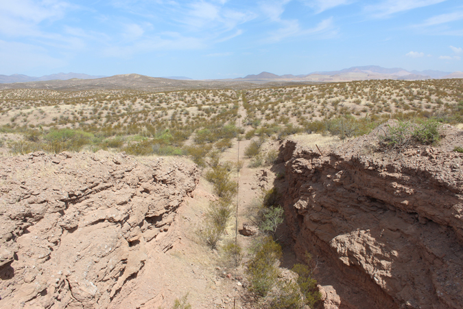
The Morenci Southern Roadbed can be intercepted several miles south on the Black Hills Backcountry Byway road. The Byway was once an early road to the town of Safford. The view below is to the west. The modern mining operation at Morenci can be seen in the distance.
 |
Just east of the Byway, the remnants of a steel bridge can be seen. This bridge was once a double span structure. One of the spans is missing. The canyon is Owl Canyon.
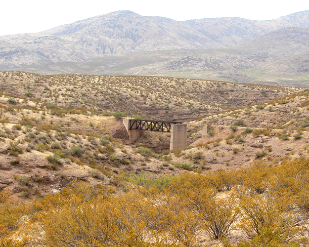 |
This is a panoramic view of the bridge structure at Owl Canyon.
 |
The photo on the left shows the deck that remains of the old bridge, while the view on the right is of metallic pieces that must be from the "missing" portion of the old bridge. I do not know if that span collapsed or was simply taken down for metal recycling or???
 |
 |
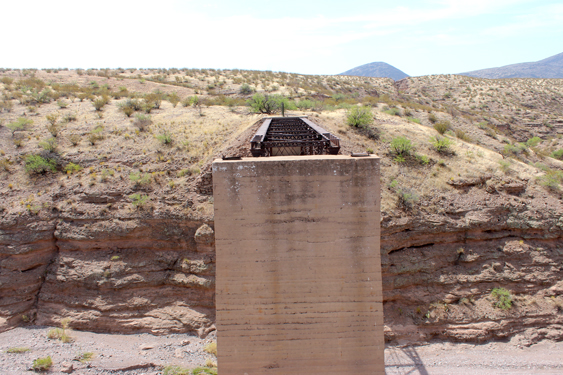
The center bridge support is very tall and quite massive.
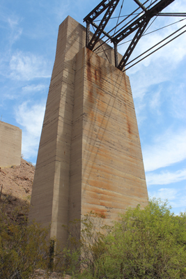 |
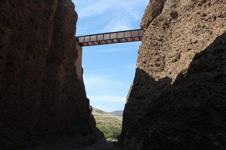
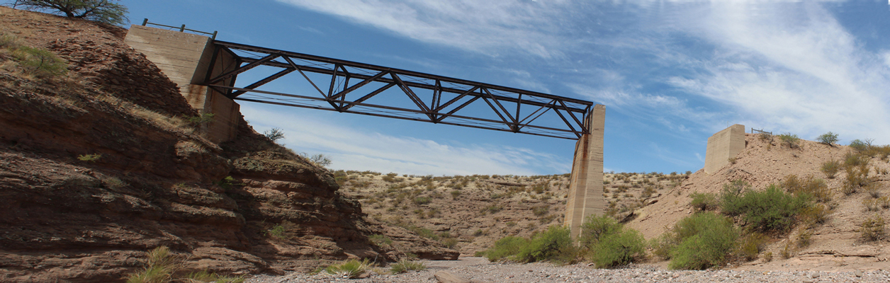
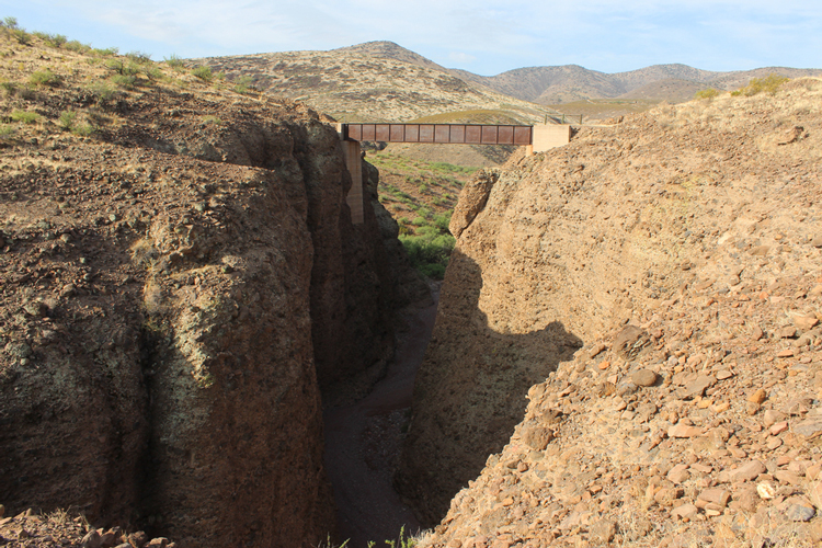
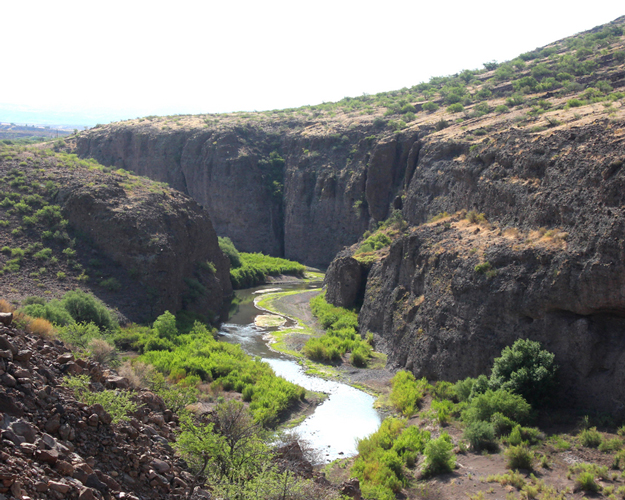
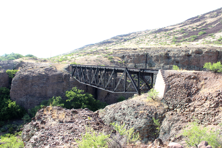
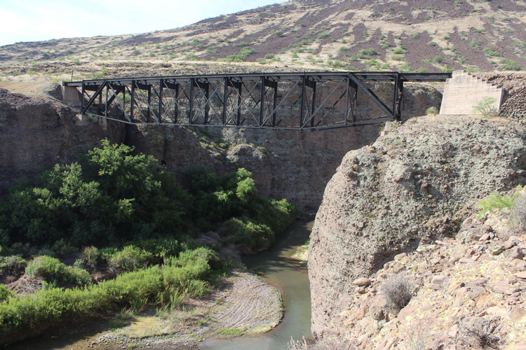
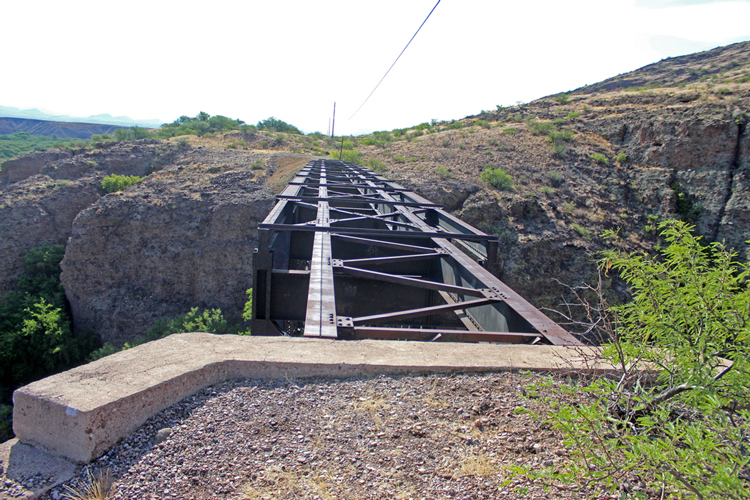
A few miles east of Owl Canyon, a narrow deep side canyon named Negro Canyon had to be spanned. A very complete bridge structure remains in place today.
 |
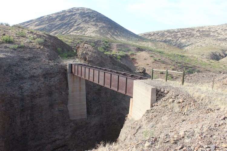 |
The deck of the old beam bridge. The bridge parts were well gussetted.
 |
This view is to the north towards the narrows of the canyon and the bridge that spans it.
 |
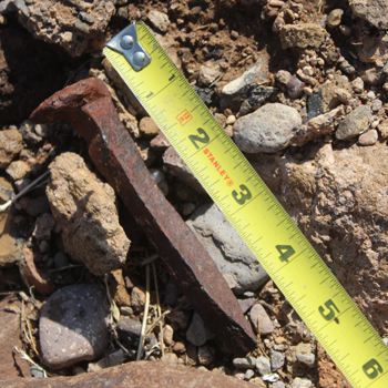
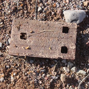
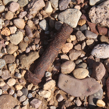
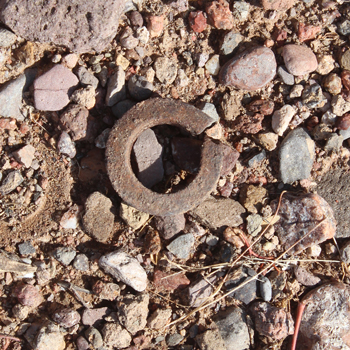
I walked the roadbed approximaely 3/4 of a mile beyond Negro Canyon to the last bridge which was the crossing of the Gila River. Along the way, a variety of smaller relics were seen including: spikes, tie plates, bolts and washers.
 |
 |
 |
 |
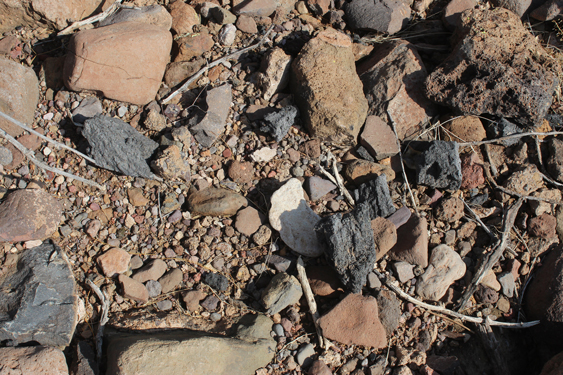
Scattered along the way were pieces of coke, which was one of the freight items brought into the area on the railroad.
 |
The Gila River Canyon as seen from the road bed.
 |
The Morenci Southern bridge crossing at the Gila River. From this crossing it was just a short distance along the south bank of the Gila River to the Guthrie station of the Arizona and New Mexico Railroad.
 |
 |
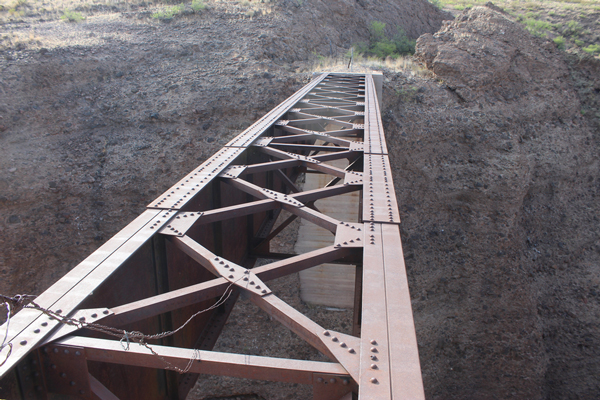
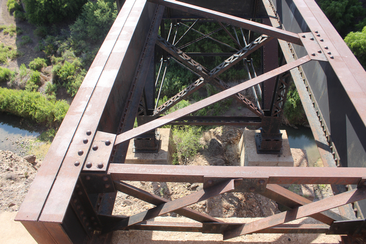
The deck of the Gila River bridge
 |
The view down through the girders of the Gila River Bridge
 |
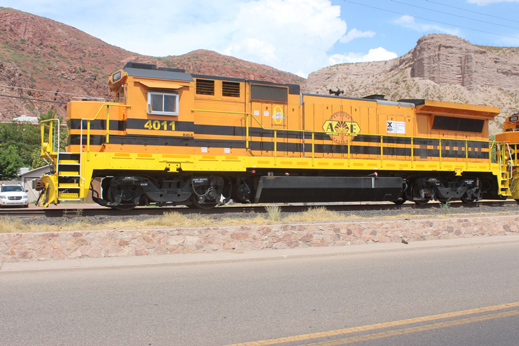
This string of Arizona Eastern locomotives was parked along the main street of Clifton. The Arizona Eastern railroad is the modern version of the old Arizona New Mexico Railroad line. It is still active carrying freight to and from the Morenci area.
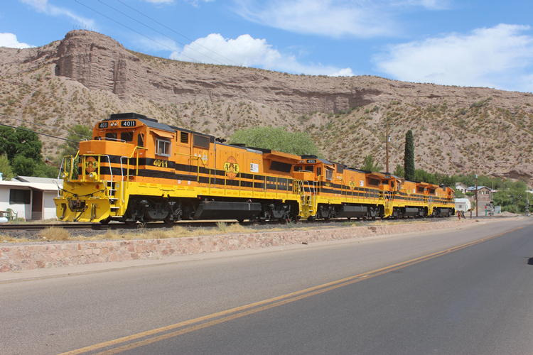 |
The locomotives seem to be sporting very new paint.
 |