 |
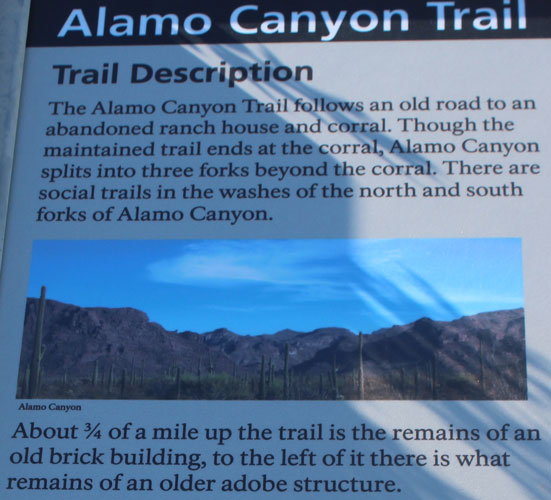
A Walk to an Old Ranch House in Alamo Canyon, Organ Pipe National Monument
|
While on a road trip to check out the town of Ajo, a ranger at the Cabeza Prieta Refuge Visitor Center mentioned that one of his favorite hikes in the area was in Organ Pipe National Monument at a location called Alamo Canyon. The ranger said that the canyon was particularly scenic and a walk there could be extended up one of the three forks that come together not too far above the ruins of an old ranch house.
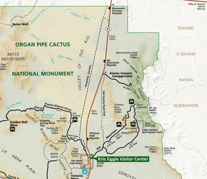
As shown on this section of the brochure of the monument, the road to Alamo Canyon is a turn off of Highway 85 approximately 7 miles south of the Monument boundary. The turn to the west comes between mile post markers 65 and 66. There are no turn bays at the intersection, so it is necessary to be aware of traffic before making the turn. From the highway, it is approximately 4 miles to the primitive Alamo Canyon Campground which serves as the trail head for the hike.
 |
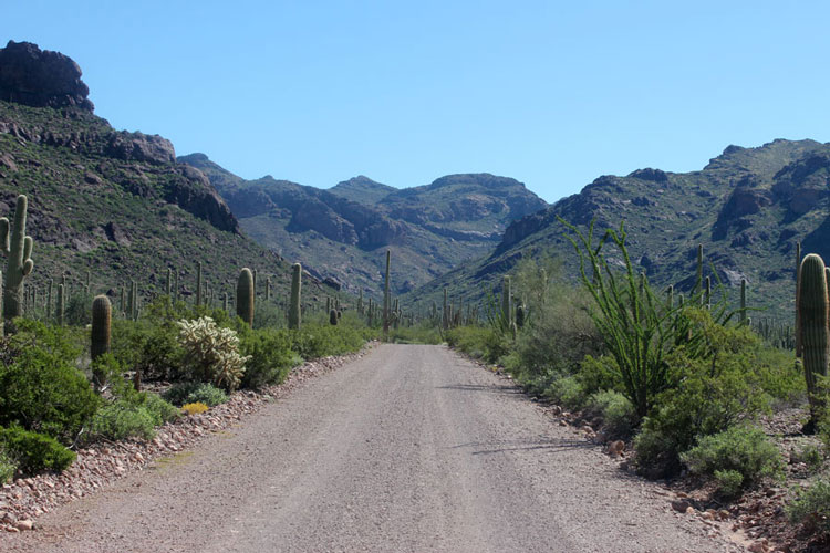
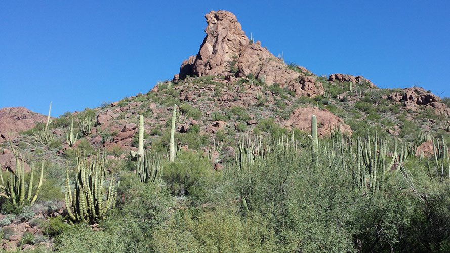
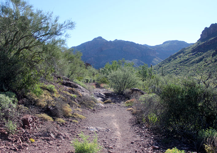
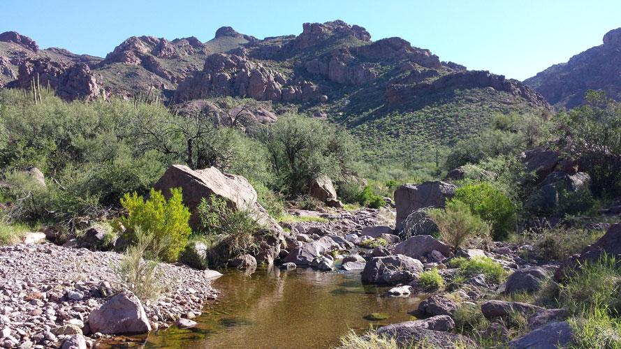
This is the view up into Alamo Canyon from the Alamo Canyon Road. The mountains are a part of the Ajo Range. The ridgeline in the distance marks the boundary between Organ Pipe and the Tohono O'odham reservation. Alamo Campground is at the mouth of the canyon. The desert plants here are spectacular.
 |
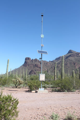
This is an emergency rescue beacon located along the Alamo road that was installed for persons who find themselves in an emergency situation. A powerful blue light shines at night to mark the location of the beacon. When we were here a "youth" group, was setting out the jugs of water seen at the base of the beacon. The group later walked up into the canyon with many other jugs of water and backpacks filled with food to be set out on one or more of the "trails". I am not sure that their activity was actually legal or permitted....
 |
A kiosk at the trail head provides a brief description of the Alamo Canyon Trail. Signs in the canyon indicate that the "social trails" are used by undocumented persons.
 |
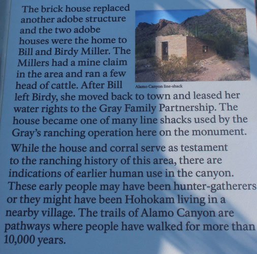
This is a summary of the history of the canyon as noted on the Park Service sign. There is no reference to the acrimony that existed between the Gray Family Partnership and the National Park Service. Because of an effective lawyer, and an ally in the form of a very powerful U.S. Senator by the name of Carl Hayden, the Gray family was able to wrangle lifetime grazing permits on the Monument. With those in hand, the family was able to treat Organ Pipe National Monument as their personal kingdom for more than 40 years. Over that time period, the family did pretty much what they wanted when they wanted . The issues only came to an end with the death of several of the Gray sons in the 1970s. A final roundup of Gray cattle conducted by the Park Service removed over 1700 cows from the monument. This was in spite of the fact that the Gray Family had lost their "lifetime" permits several years before the sons' deaths....
A report here describes the history of ranching on the monument which is essentially the history of the Gray Family.
 |
There are quite a few specimens of the Monument's namesake cactus along the Alamo trail and the hillsides nearby. What are missing are the "Alamos", the canyon's namesake plant. Alamo is the Spanish word used for cottonwood tree. There are very few, if any, of these trees. to be seen in the canyon.
 |
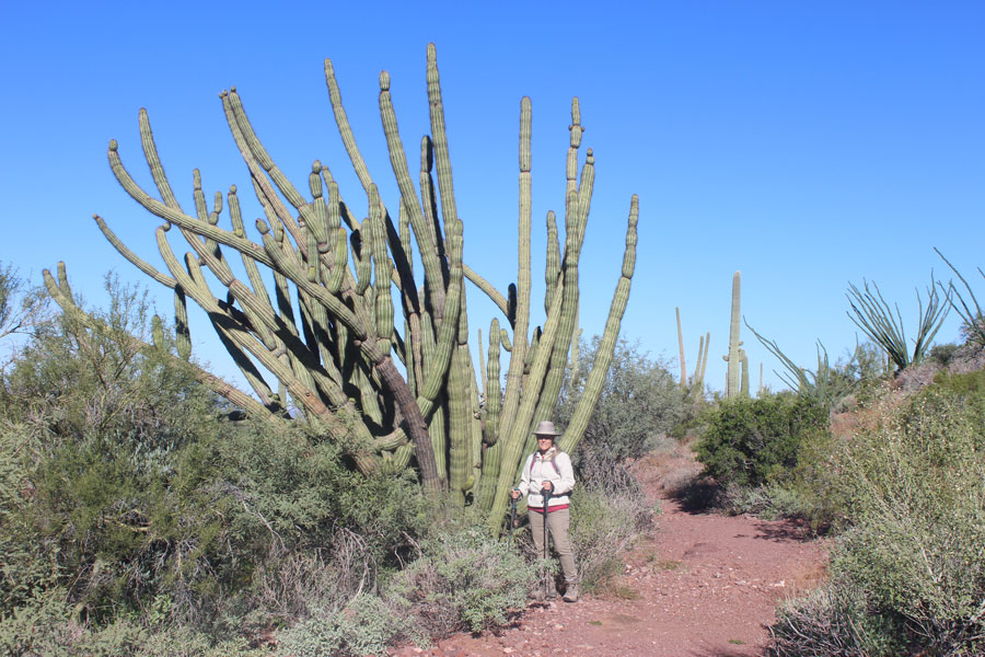 |
Up in the canyon, the old roadway narrows to a single track that runs above the bed of Alamo Wash.
 |
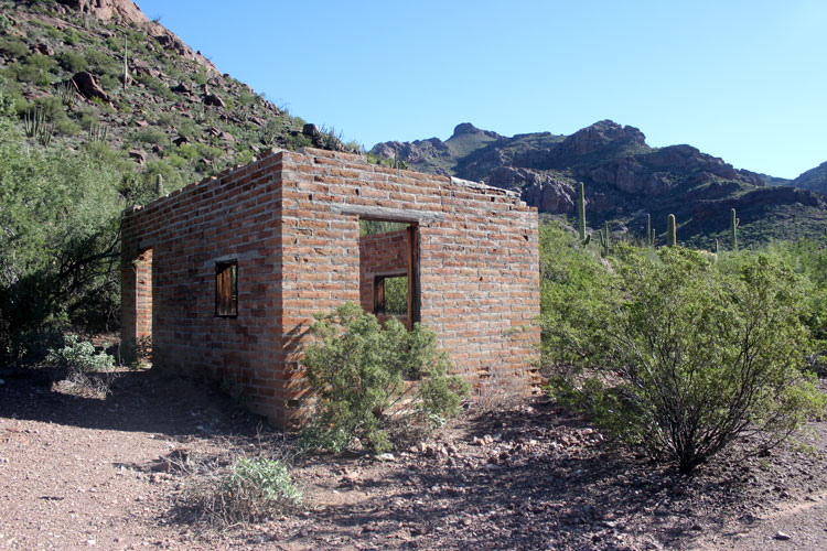
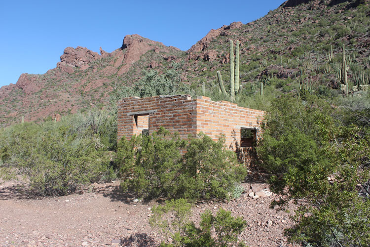
It is unknown whether this building was constructed by the Millers or by the Gray Family. Contrary to the information on the signage at the trailhead, this location was more than a line camp for the Grays. Two of the sons lived here for quite a few years. It is interesting that the Gray family owned very little land. They were content to lease buildings, corrals, and wells from other owners.
 |
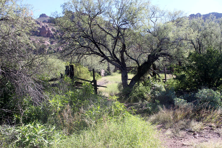
Upstream from the ruin of the old house are the remnants of a corral, water trough and a water tank.
 |
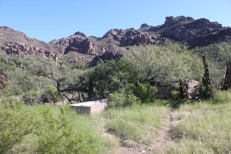 |
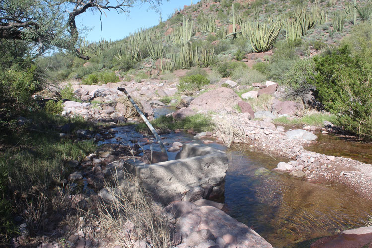
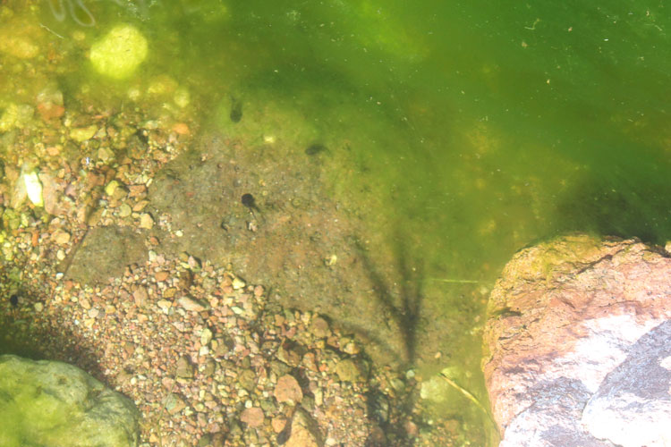
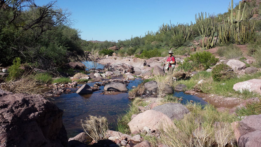
The first Anglo settlers in the canyon, the Millers, came here because there seemed to more water available than where they had lived in the Puerto Blanco Mountains to the west. This concrete structure was once a well that probably had a wind mill standing over it. When we were here in October, there was a nice stream of water flowing. The spadefoot toads were taking advantage and many of the pools were filled with tadpoles.
 |
 |
 |
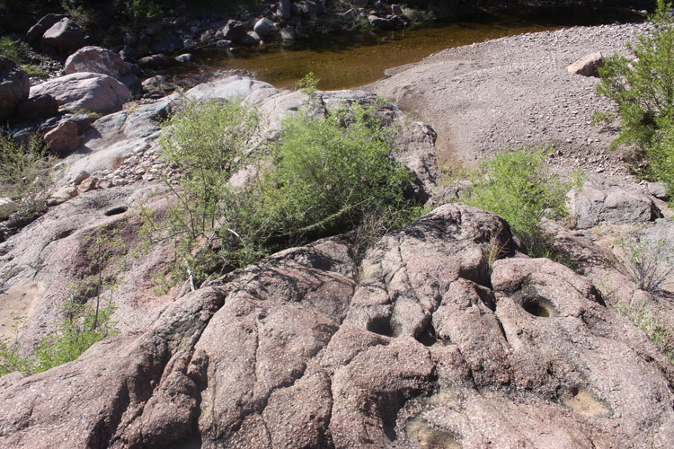
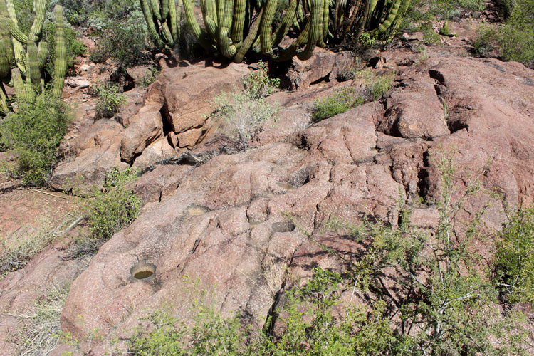
There is a set of rock mortars in a large rock formation across the wash from the old corral. The speculation is that these were Hohokam in origin.
 |
 |
Our plan had been to walk aways up the canyon beyond the old corral, but a large gathering of bees and wasps in several of the bushes along the way made us think twice about continuing. The creekside had been so pleasant that instead of walking the old road back to the trailhead, we made our way along the wash.
 |