 |
The Ruins of Old San Carlos
|
Old San Carlos is the site of the original Indian agency and a military post that were established on the San Carlos Apache Reservation in the 1870s. The agency was located on a low bench near the confluence of the San Carlos River and the Gila River approximately 35 miles southeast of Globe. The site was abandoned in 1929, and was soon flooded by the rising waters of the newly created San Carlos Reservoir in the 1930s. When the lake levels are low, the foundations of the old agency and army post are exposed and are interesting to visit.
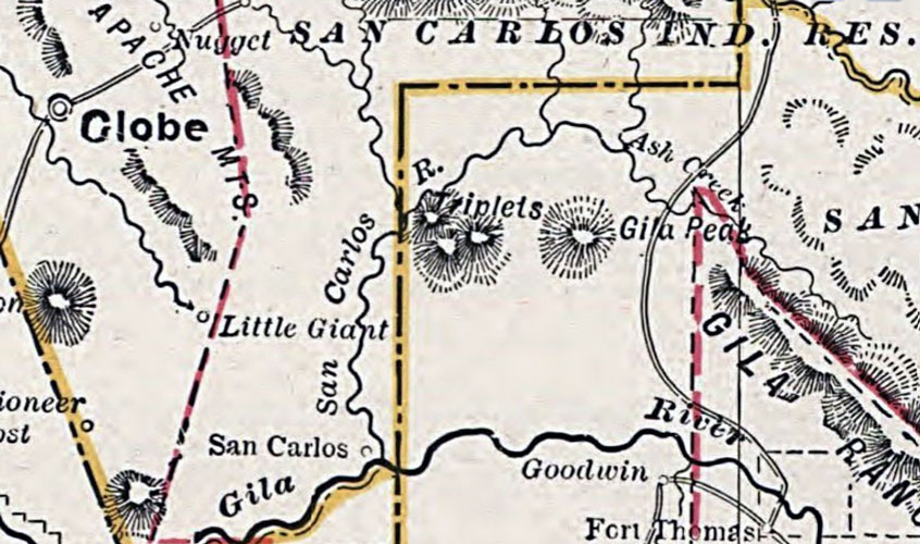
The location of San Carlos was indicated on this map pulished in 1877:
 |
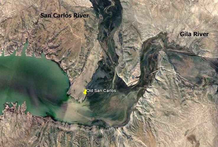
When it became evident that the San Carlos site would be affected by the construction of Coolidge Dam on the Gila River, a new administrative site was established at the community of Rice several miles upstream on the San Carlos River. In 1931, the name of Rice was changed to San Carlos. The original San Carlos then became known as "Old San Carlos." This was the Google Earth view of the site in 2016.
 |
During the 1870s and 1880s, in particular, life was very difficult at San Carlos. There were many issues and conflicts. The cavalry units that were stationed there were kept very busy. Some of the more notable incidents involved the Apache leader Geronimo and his followers.
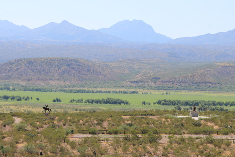
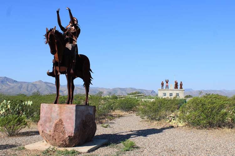
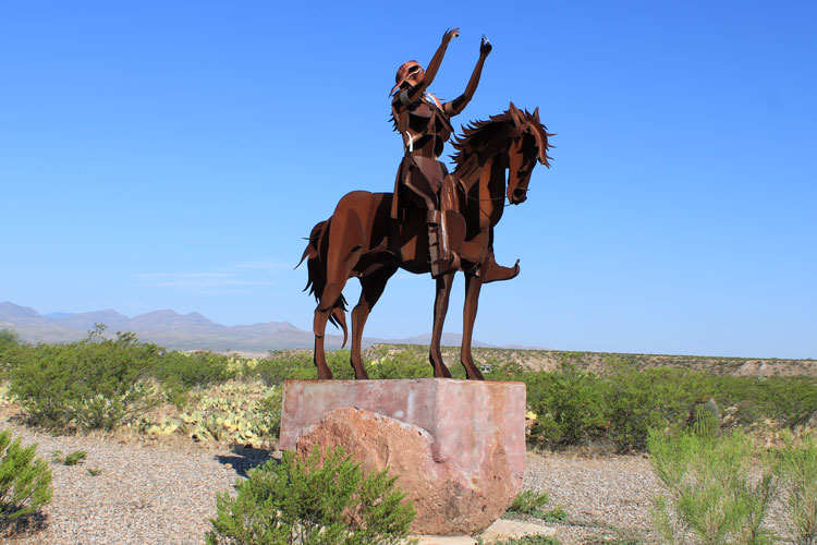
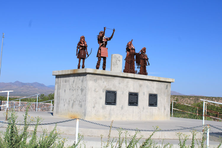
In 2009, on a bluff overlooking the old site, the San Carlos Tribe dedicated the "Old San Carlos Monument" to memorialize the difficult times endured by the Apache people during the early years of the reservation. The date for the dedication, Feburary 17th 2009, was chosen to honor the 100th anniversary of the death of Geronimo who had quite a history with this place.
Five metal statues that represent an Apache warrior and an Apache family are the central parts of the monument. Several plaques express tribal members' thoughts on the past, present, and future history of the tribe.
 |
 |
 |
 |
In 2008, as part of the "Images Across America" book series, "Old San Carlos" was published. This book documented the histories of both the Indian Agency and the military post. The authors were Paul and Kathleen Nickens. I found "Old San Carlos" to be very useful when I visited the site in September of 2019. The historic photos in this trip report were used in the Nickens' book.
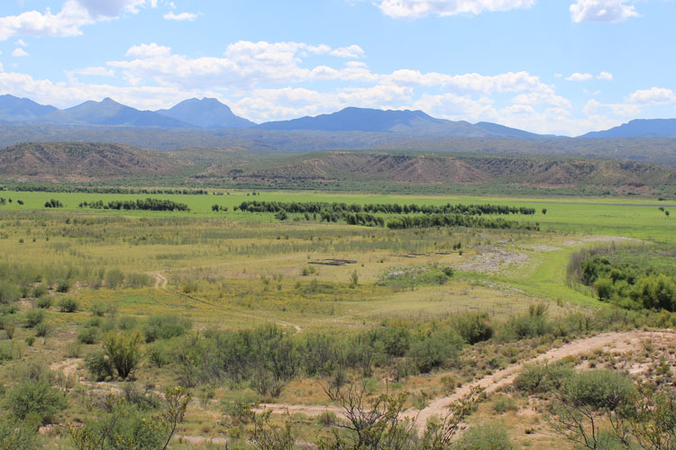
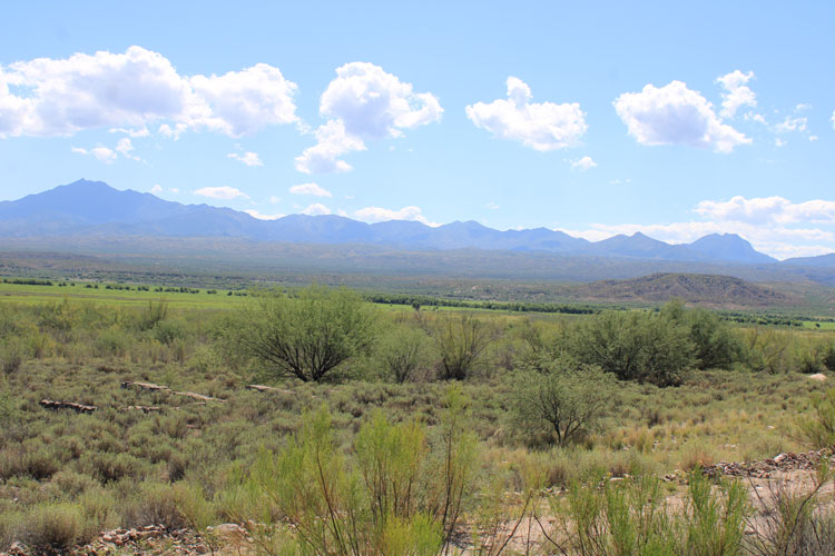
This was the view in 2019 from the San Carlos Monument down onto the low lying bench that was the site of Old San Carlos. A few foundations can be seen. At this location on the edge of the bluff, there is a old foundation that once supported a water tank that provided water to the agency.
 |
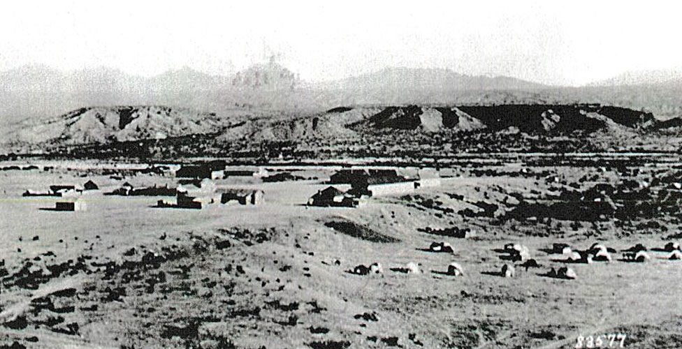
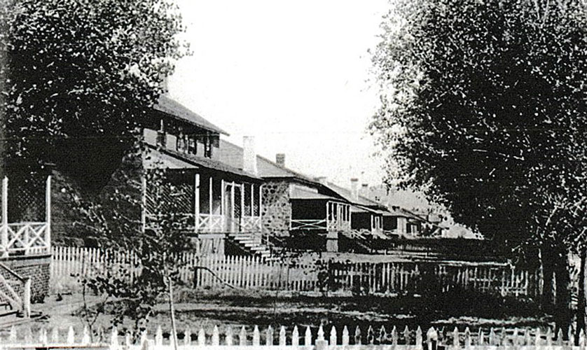
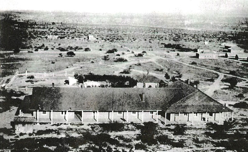
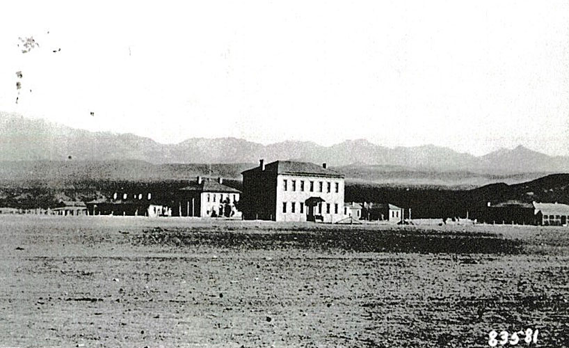
In 1895, this was the view of the Indian Agency. The Gila River was in the distance. Apache encampments can be seen to the right side of the photo.
 |
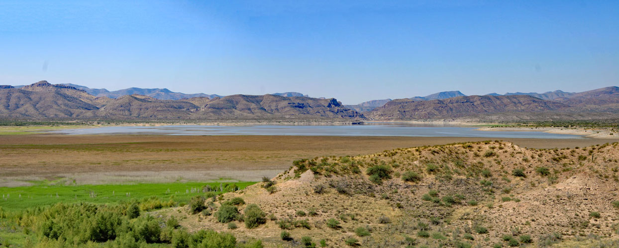
In September of 2019, San Carlos Reservoir was very low and the edge of the lake was quite a distance from Old San Carlos. There were no issues walking or driving down onto the site.
 |
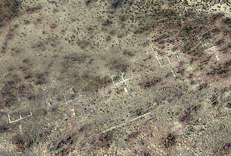
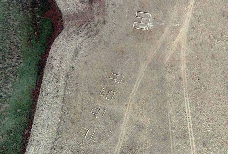
The outlines of the buildings in this Google Earth view are the foundations of several buildings that made up "Officers' Row" at Camp San Carlos, the military post that shared space with the Indian Agency. The permanent buildings that were constructed here in the 1890s replaced the tents formerly occupied by the army officers. Originally, there were 12 of these officers' quarters.
 |
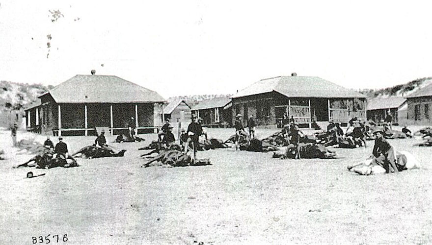
This Signal Corps photo from 1894 showed several of the Officers' Quarters.
 |
In 1900, when the army abandoned its camp, the officers' quarters were taken over by the San Carlos Indian Agency. The quarters were re-modeled and turned into housing for Indian Agency employees. Trees were planted and the picket fences were added to create a more residential atmosphere.
 |
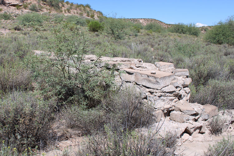
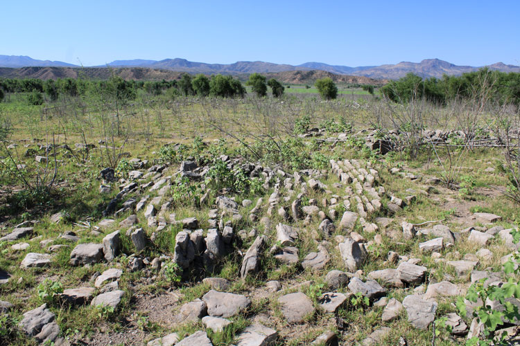
This is one of the foundations of the officers' quarters. These foundations were easier to spot in Google Earth than they were at ground level. The foundations were constructed of quarried stones grouted with cement. Approximately 10 of these foundations remain. When the San Carlos Agency was abandoned, the buildings were dismantled and their materials were re-used elsewhere.
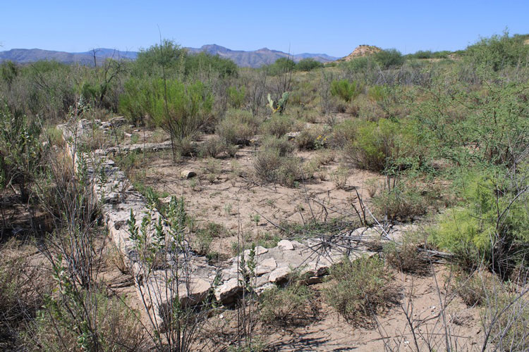 |
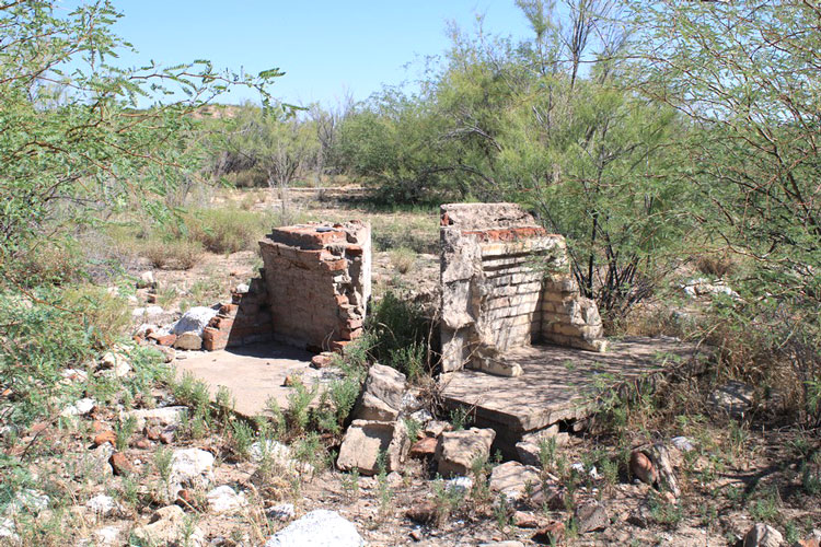
Parts of brick fireplaces remain in several of the old officers' quarters. These fireplaces do not have the angled sides that are more common in modern fireplaces.
 |
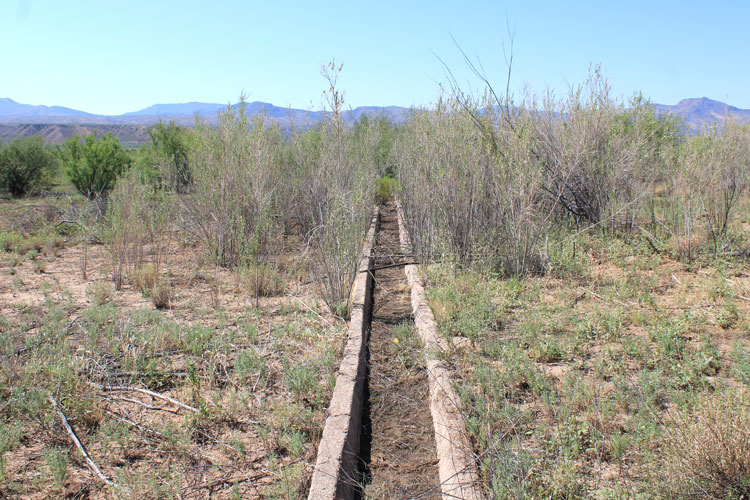
This is the linear structure that runs across the front of Officers' Row in the Google Earth Image. My guess is that it was a small irrigation ditch. There are several examples of these elsewhere at the Old San Carlos Site.
 |
North of the Officers' quarters was the Post hospital. This was its appearance in 1895. After the military camp was abandoned, the building served as a hotel, and was then re-established as a hospital for the Apaches.
 |
The foundations peeking out of the brush here once supported the Post hospital.
 |
Similar to the construction of the foundations of the officers' quarters, the foundations of the old hospital were also constructed of quarried stones and grouted with a cement based mortar.
 |
In 2016, when this Google Earth view was taken, the lake was much closer to the Old San Carlos site than what it was in 2019. In his book, Paul Nickens speculated that these structures were constructed sometime after 1913 and had replaced the Agency buildings that were in the 1895 photo at the top of this report.
 |
A different technique was used in the construction of the newer foundations. Poured concrete was used instead of quarried stone. The impressions left by the wooden forms can be seen in the sides of these low walls. Very little remains here of the materials that were used in the construction of these buildings.
 |
 |
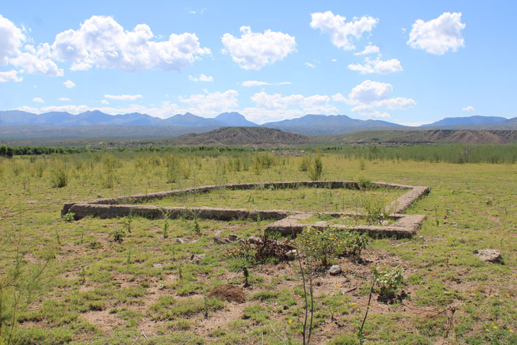
Elsewhere at the Old San Carlos site, there are other buildings that were constructed after 1900. The Lutheran Church, and its parsonage were constructed around 1911. In 1929 the buildings were dismantled and the materials were re-used.
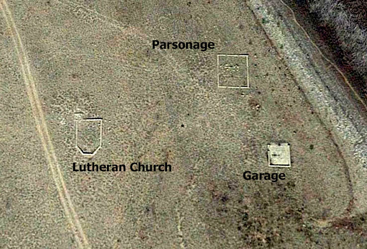 |
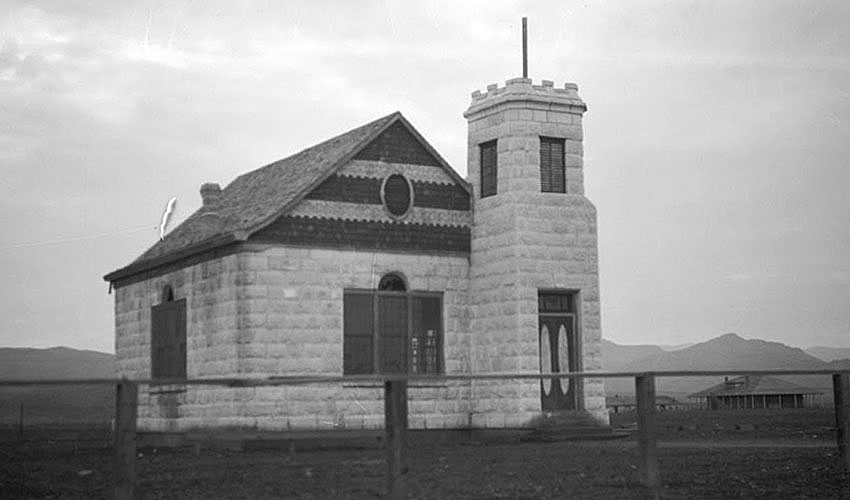
The Lutheran Church at Old San Carlso was of very interesting construction. The material used was Tufa Stone, a volcanic rock that was quarried on the reservation. The stone was strong, lightweight and very easily cut loose from its source. Pretty much every building at old San Carlos that was made from this rock was dismantled and its materials re-used.
 |
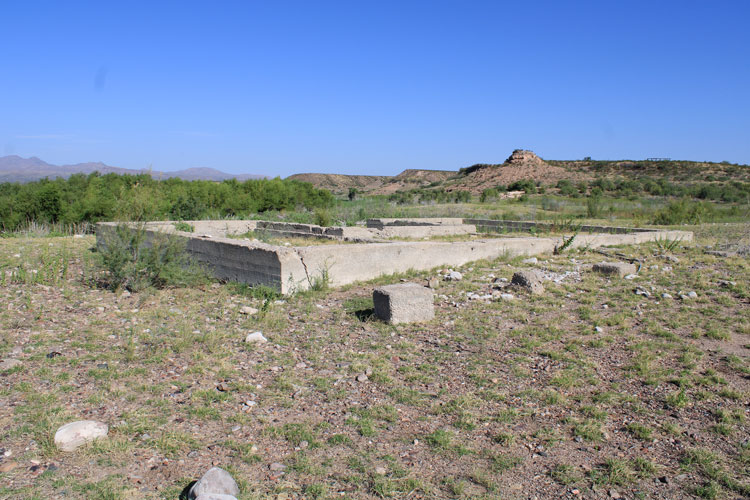
This is the ground level view of the poured concrete foundation of the old Lutheran Church. Very few, if any of the Tufa Stone blocks were left behind.
 |
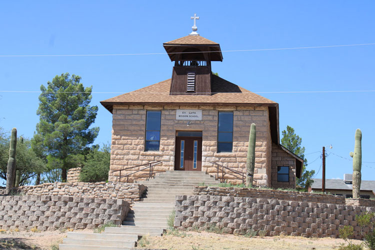
The Tufa Stones from the Lutheran Church at Old San Carlos were incoroporated into the construction of this building that was located a few miles north.
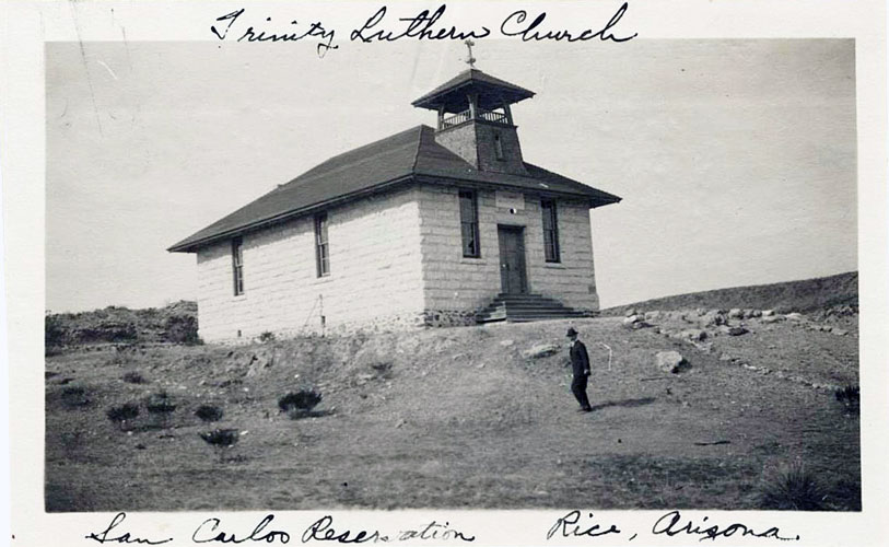 |
This is the current photo of the building above. The location is now identified as Peridot. The building is part of a Lutheran school. At some point in time, re-modeling was accomplished and the structure's size was increased dramatically.
 |
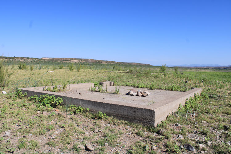
The garage that was used by the Lutheran minister is the only building at the Old San Carlos site that seems to have had a concrete floor.
 |
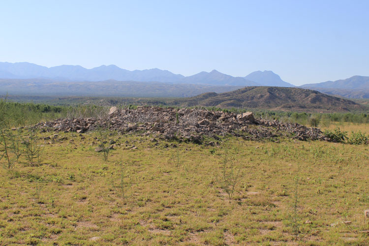
Not all of the buildings at Old San Carlos were carefully dismantled. The two story building in the center of this photo was a school building. It was dynamited down in 1930.
 |
This is the current view of the old school building. The pile seems smaller than expected for what seemed to be a large building. Perhaps some of the materials were carried off and re-used elsewhere. The stone materials here were not Tufa Stones.
 |
The walls of the old Agency Guardhouse were also dynamited. It appears that this wall simply laid over after the explosion. The courses of stones have maintained their relative position. These stones were not Tufa Stones.
 |
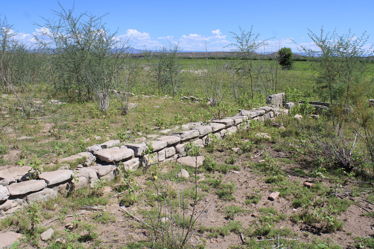
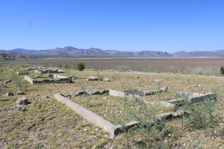
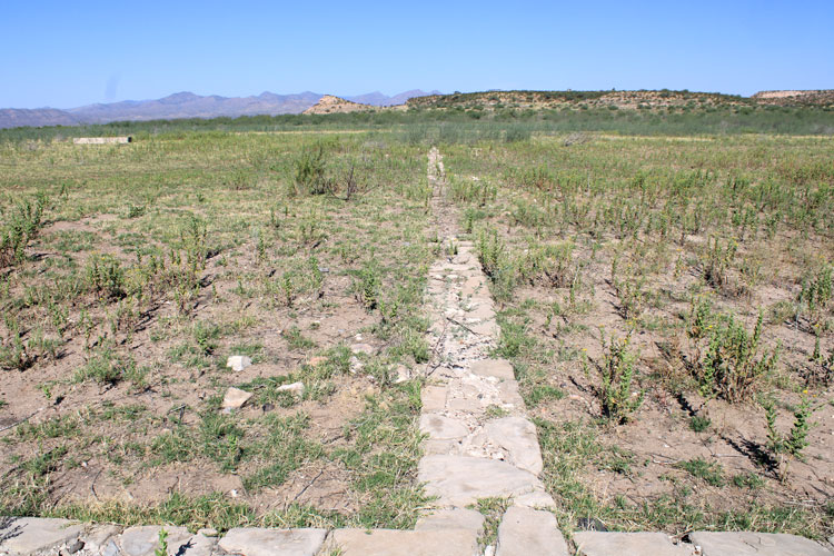
There are many other foundations and outlines of buildings at the San Carlos site that were not identified in the Nickens Book. A couple that are very long, as in hundreds of feet long, are interesting. There were apparently several warehouses that were used by the Agency that were made of adobe and were described as 300' long. This is one of the foundations that is that long.It would be interesting to know whether it was associated with one of the huge warehouse buildings.
 |
San Carlos Recreation Permits are required to visit Old San Carlos. The location can be reached on dirt roads that begin with a turn off the Coolidge Dam Road south of Highway 70 near Peridot. In 2019, a crude sign identified the turn. At the 1st major fork, the route is to the right, There may be signs at the other branches. The tribe provides these co-ordinates for the San Carlos Monument: N 33° 12' 12.7" W 110° 25' 47.3"