 |
A ride to
check out Pearce Ferry Rapids on the Colorado River
near Lake Mead Arizona
|
For many decades, Pearce Ferry, located on Lake Mead's Pearce Bay, was considered to be the boundary between the lake and the Grand Canyon. Pearce Ferry was a popular access point for boaters, and many Grand Canyon rafting trips ended their trips here.
Today, Pearce Ferry is no longer lakeside. A persistent drought has changed the area dramatically. The lake is more than 15 miles away. In its place, there is now a free flowing Colorado River. As the river has re-established itself, a very intense and active rapids has formed in the new river channel. These rapids are supposed to be as impressive as any in the Grand Canyon. We had to go check this place out.
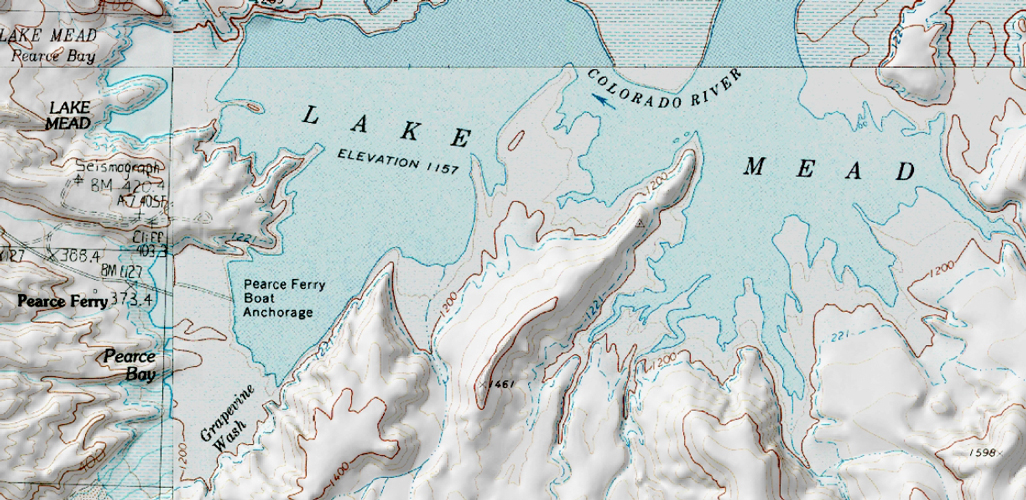
This section of topographic map is from the days when Pearce Ferry was an access point to Lake Mead. The lake is currently 75 feet lower.
 |
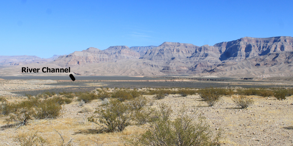
Dark vegetation now marks the area that was occupied by Pearce Bay on Lake Mead. The new Colorado River channel can be seen cutting across the former lake bed. Pearce Ferry Rapids has formed in the channel to the left side of the photo.
 |
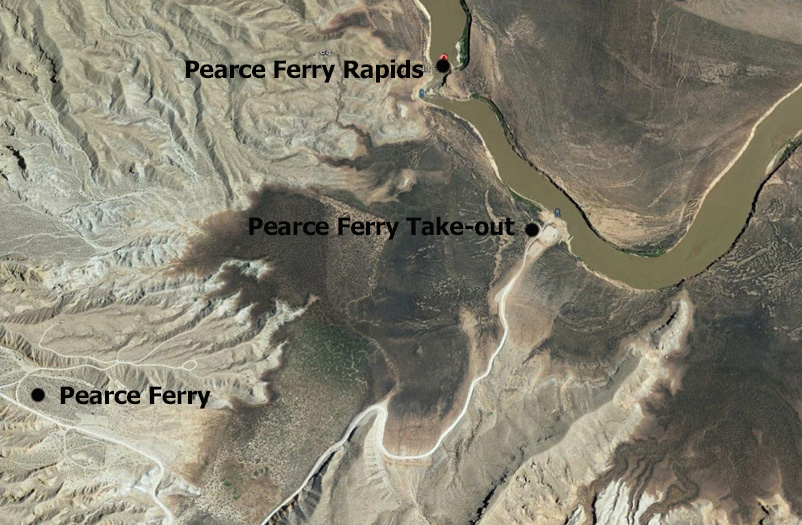
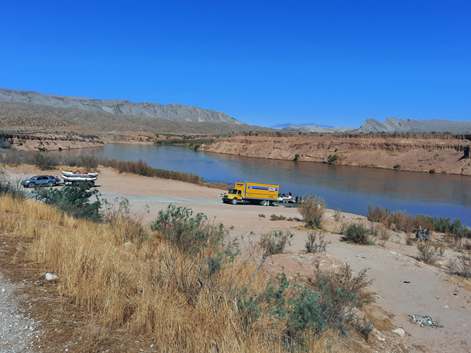
In 2010, a road was constructed from Pearce Ferry to a location on the river that is just upstream from the Pearce Ferry Rapids. A take out ramp was established at the end of the new road. This construction allowed the rafting of the lower reaches of the river through the Grand Canyon to be restored.
 |
The take out ramp at the end of the Pearce Ferry Road is a simple affair. After this group of rafters had loaded up and pulled out, we were the only people left in the entire area.
 |
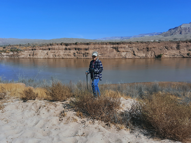
It is approximately a half mile walk from the boat ramp downstream to Pearce Ferry Rapids. Silt layers that were deposited in Lake Mead are now exposed and appear in the background of this photo. It has been speculated that these may extend to a depth of several hundred feet.
 |
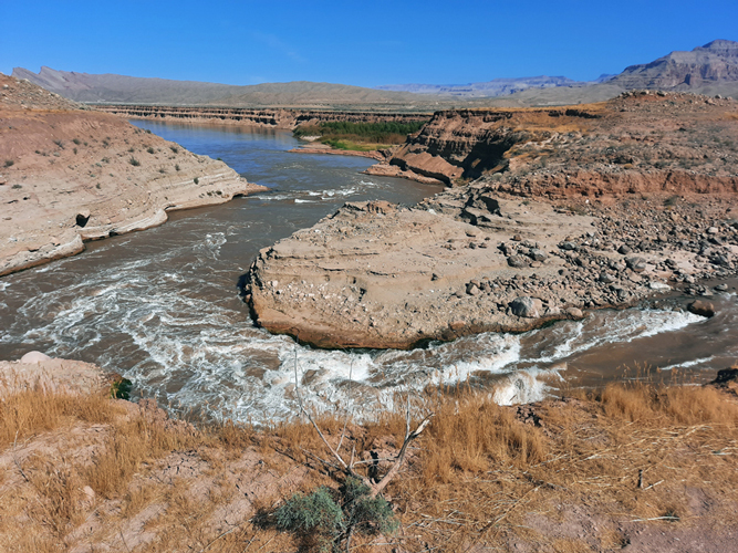
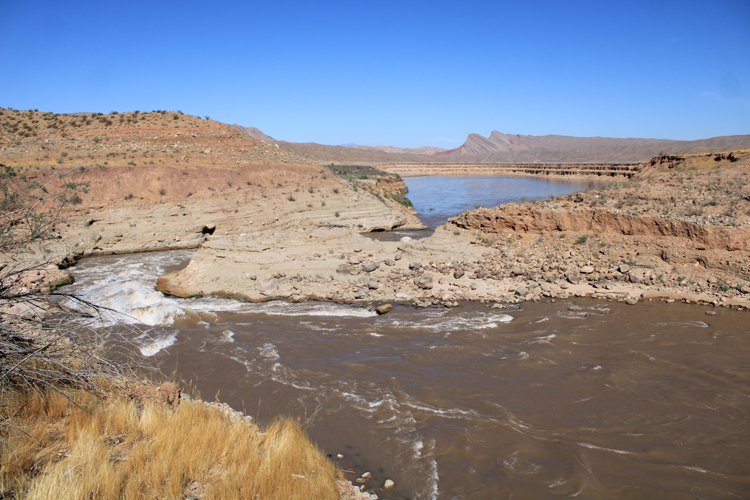
This was the appearance of Pearce Ferry Rapids on the day that we were here in October of 2020. The flow rate was approxmately 13,000 cfs. At this rate, the rapids are considered to be runnable by skilled kayakers and rafters. We have posted a short video on Youtube of the rapids.
 |
The modern "Pearce Ferry" was named for a ferry crossing that was established in the area by Mormons in the 1870s. At the time of our visit to the rapids, we had little information as to the location of the old crossing. After our return home, I came across an interesting Facebook Group: "Southwest Ferry Project". The administrators of this group include the history of the crossing in their content. In summary, the crossing was estalished to provide assistance to Mormon settlers who wished to move into this part of the Arizona Territory. At the time, the only other crossing on the Colorado River was at Lee's Ferry more than 270 miles upstream. The ferry was apparenly not very profitable, but did operate intermittently until the 1930s.
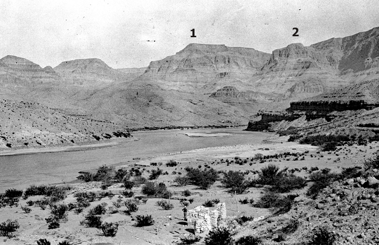
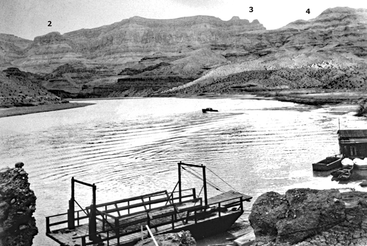
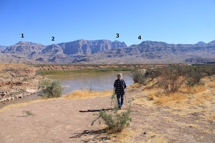
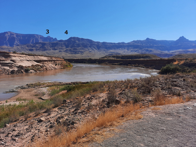
Two historical photos that are presented in the Facebook group show the Ferry crossing in 1923, and in the 1930s. I was able to locate landmarks in those photos that also appear in photos that I took on our visit. It seems that we were pretty close to the location of the orginal crossing. If we had had the old photos on our trip, we might have been able to zero in a bit closer. I think that if we had walked just a bit further upstream that we would have been there.
 |
 |
 |
Perhaps if we had walked around this next curve, we would have been there......
 |
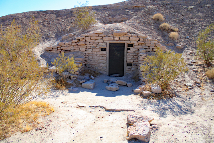
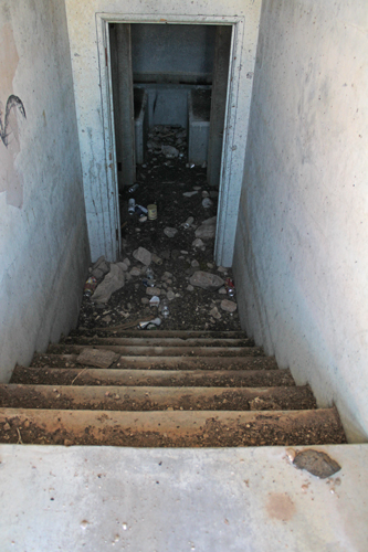
In the 1930s, a Civilian Conservation Corps camp was established at Pearce Ferry. The men stationed here were tasked with developing recreational facilities in this area of the lake. An underground storage room where dynamite blasting caps were stored, and several foundations of other buildings associated with the old camp remain at the site.
 |
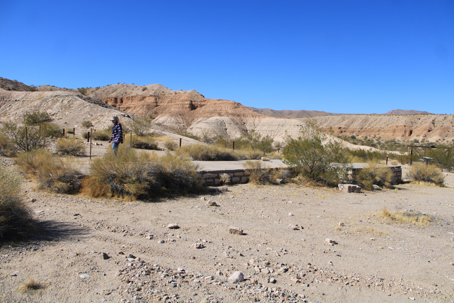 |
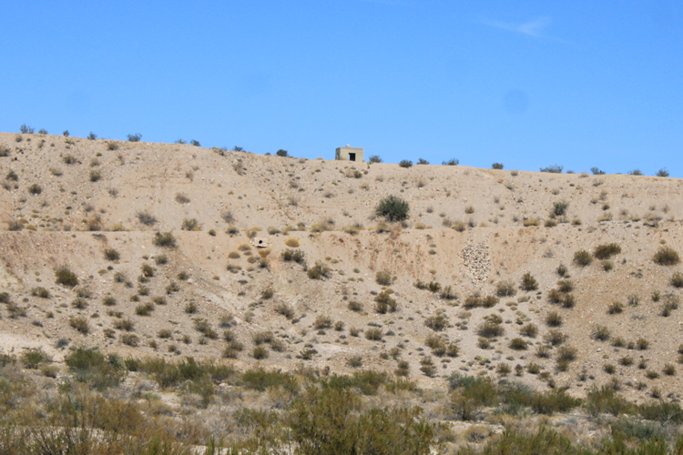
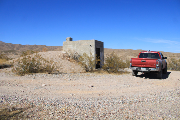
As Lake Mead began to fill in the late 1930s, government officials became concerned about the effects that the weight of the water would have on the underlying rock formations. Several earthquake monitoring stations were constructed around the lake. One of those was located on a hillside above Pearce Ferry. There are two concrete structures that remain from that station. One housed a generator that provided the electricity to run the monitoring equipment. The other structure, which included an underground bunker, housed the monitoring equipment itself. Earthquakes were monitored that were attributed to the presence of the lake.
 |
The generator building:
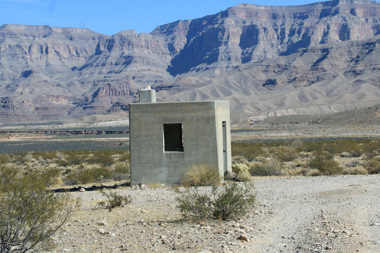 |
The bunker that contained the earthquake monitoring equipment.
 |
 |
One access to Pearce Ferry is from the 50+ mile long Pearce Ferry Road that exits Highway 93 between Kingman and Hoover Dam. The road is paved except for the last 7 miles down to the boat ramp on the river. The Grand Wash Cliffs, which mark the end of the Grand Canyon, are in this view to the east. Pearce Ferry is in the low area in the distance.
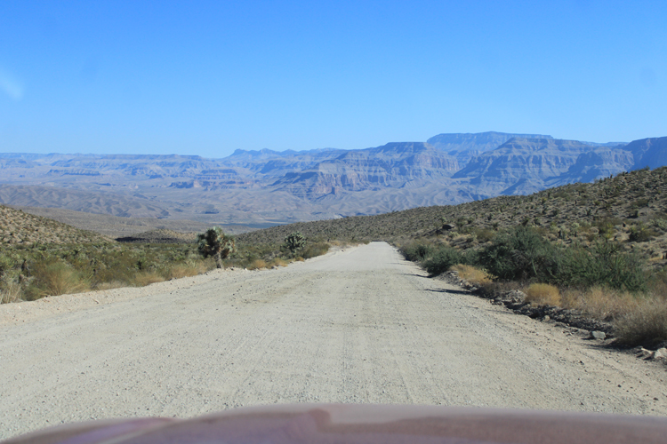 |
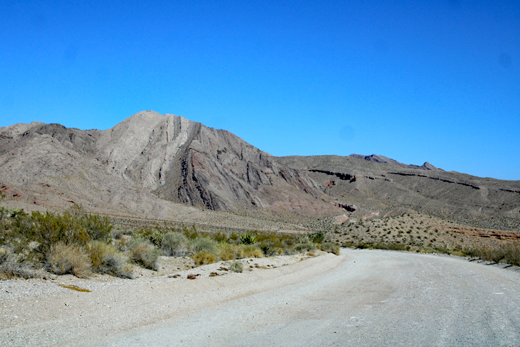
The same layers of rocks that make up the Grand Wash Cliffs to the east are standing vertically in this view to the west. Geologically speaking, something very dramatic has happened here.....
 |
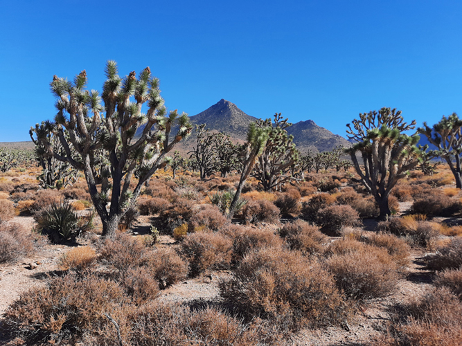
Near the community of Meadview, the Pearce Ferry Road passes through a forest of very large Joshua Trees.
 |
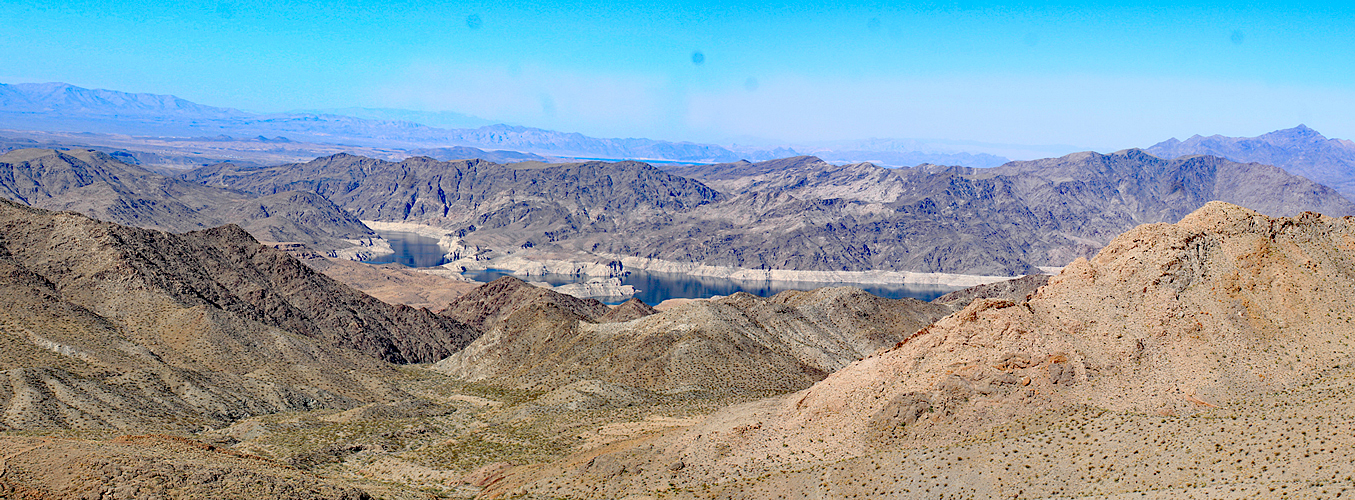
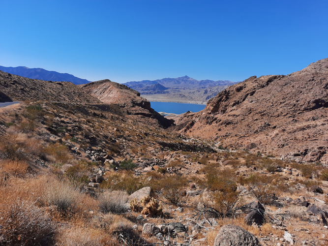
This dramatic view of Lake Mead presents itself on the ride to Pearce Ferry.
 |
The paved portion of Pearce Ferry Road goes to South Cove, a popular access point for the upper areas of Lake Mead.
 |