 |
Quick Trips and Reports 2009 | |
|
Quick Trips and Reports 2009 | |
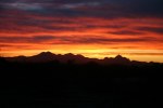
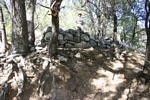
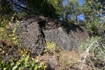
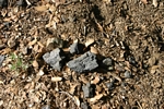
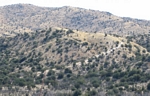
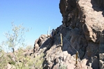
Apache Mine Camp site Catalina Mountains southern Arizona
In the early 1880's a mine camp was constructed with the idea that it would support anticipated production from the Apache Mine on the north side of the Catalina Mountains. An early author wrote: "At Apache Camp the company built a twenty-ton smelter at once--without waiting to develop the mine. They also put up a large hotel, several company buildings, and a tram from the mine to the smelter". In six months, the company took out about $20,000 of copper ore but had spent 10 times that amount in development and were forced out of business. Today, the camp is reached from a 4wd spur road off the Control Road on the "back" side of Mount Lemmon. About all that remains are several rock foundations that were probably building sites, the slag pile from the smelter, and pieces of copper ore and coke. The coke was brought in to fire the furnaces of the smelter but proved to be too expensive. Charcoal pits were constructed somewhere in the area and some charcoal was produced that was going to be used instead of the coke.
 |
 |
 |
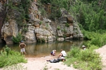
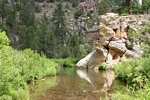
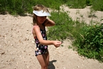
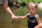
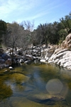
Kinder Crossing on Clear Creek in Arizona
Kinder Crossing is on an old pack trail that crosses Clear Creek on the Mogollon Rim north of Blue Ridge Reservoir in Arizona. The crossing is reached by a short(3/4 mile) moderately steep hiking trail. Our 3 year old grandson and 6 year old granddaughter went up and down the trail with no problems. The dirt road to the trailhead could be treacherous when it is wet. It was dry on the day that we went for our walk, but there were VERY deep ruts in the road from previous travelers. The bottom of the trail brings you to a nice area that has been used for camping. There is a sandy swimming hole very close by. A great time was had by all to see who could catch the largest crawdad.
 |
 |
 |
 |
 |
 |
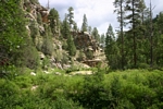
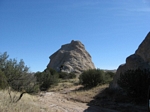
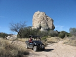
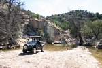
Rhino ride on the Chimney Rock 4x4 trail southern Arizona
The Chimney Rock trail is a popular 4wd/ATV trail off the Redington Pass Road east of Tucson, Az. The guidebooks describe it as a "difficult" trail. It is about 8.5 miles long and connects on both ends to the Redington Road. This trip was my first ride in my brother in law's Yamaha Rhino. I was very surprised at it's performance. It handled all of the rough spots in the road with ease and was incredibly smooth riding--especially in the rocky wash on the northern end of the road. It handled the road much more easily than my 4wd trucks would have. We happened to hit the trail when it was dry--there was evidence that sections of the road could be very muddy. Pools of water were nice to see in the wash. According to the guidebook we traveled the road in the "easier" direction from south to north.
 |
 |
 |
 |
 |
 |
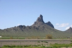
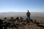
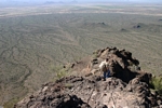
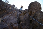
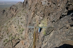
Dayhike to Picacho Peak State Park Arizona
Picacho Peak is a very prominent volcanic peak near I-10 north of Tucson. In February, I talked my son Jerry into hiking the peak. We traveled the Hunter Trail, a steep 2 mile trail that starts on the north side of the peak and then crosses to the southside for a very steep finish to the summit. Cables are installed in the very steepest stretches for use as handholds. It would be handy to have gloves for those areas. The view from the top is extensive in all directions! We encountered few people on the trail, but the summit space was filled. Needless to say we did not stay long.
 |
 |
 |
 |
 |
 |
 |
| Trips |
| Home |