 |
A Seven Day Kayaking Trip on The San Juan River of Southeastern Utah
|
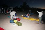
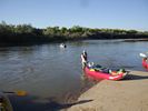
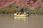
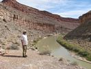
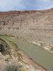
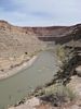
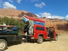
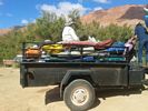
In early October, I joined three former high school students of mine and four of their friends on a weeklong non-commercial float trip on the San Juan River of southeastern Utah. The trip began at Sand Point near Bluff Utah and ended 83 miles later at Clay Hills Crossing where the river empties into Lake Powell.
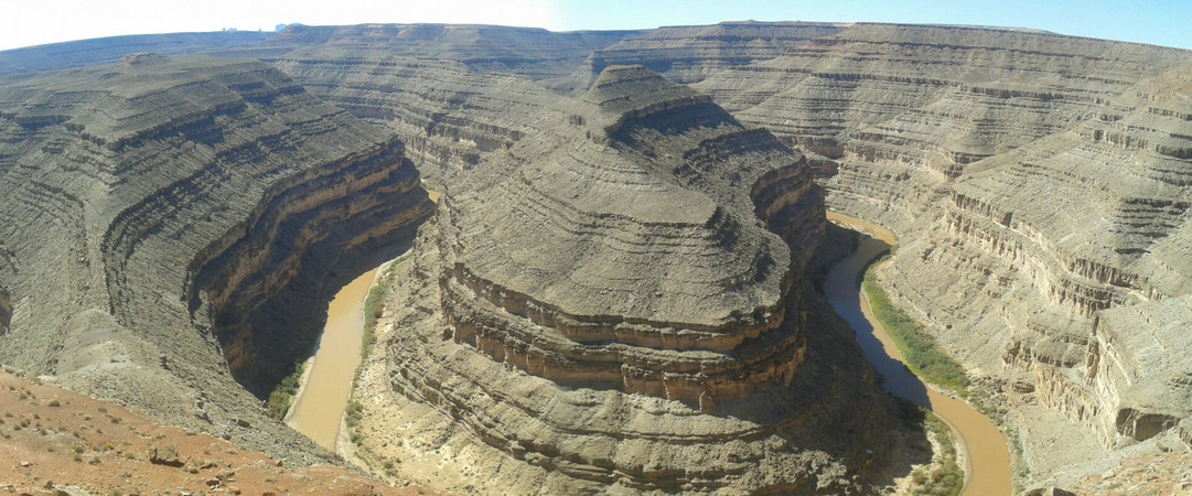
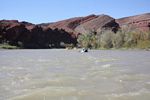
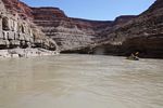
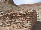
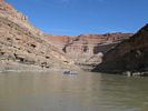
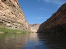
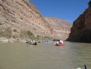
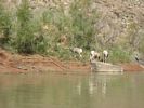
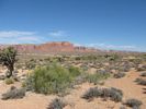
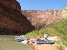
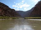
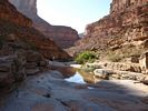
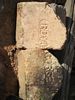
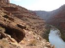
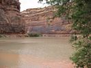
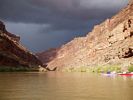
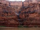
The majority of the trip was spent in a deep narrow canyon with spectacular walls. The layering in the rocks reminded me of the Grand Canyon. Particularly interesting were the meanders of Goosenecks State Park. We saw many bighorn sheep, several deer and even one of the beavers that make the river their home. As we drifted along, we passed several early Native American cultural sites. And we pulled out at several locations where there was evidence of early 20th Century gold mining and oil exploration activity.
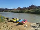
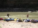
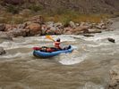
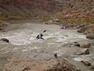
This was my first whitewater river experience. As a river "newbie", I found the travel to be both exciting and at times intimidating. The "ideal" volume of flow to run the river is around 2000 cfs. During our trip, the flow was down to about 600 cfs. While there was less current to deal with there were more exposed rocks. And the rapids and riffles were trickier to get through. My secret was to trail close behind one of the more experienced kayakers like a baby duck does to its mother. I tried to go where the leader went and to do what he did. That usually worked pretty well. I did get hung up twice in two different rapids, but I never did flip out of my boat and both times got myself loose.
Government Rapids did spook me out. The afternoon that we arrived there, I didn't feel confident enough to give it a go. One of the guys graciously drove my boat through while I walked around. Below Slickhorn Canyon, the current in the river lessened. The other guys were hoping for a storm to come up and add water to the river's flow. I was very content with the way that it was......
I learned a lot on this trip about the basics of whitewater river running. I am not sure yet whether it is my cup of tea. Next year's trip is on the Green River. That one may be more my speed.
Click on Photos to Enlarge:
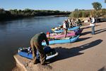
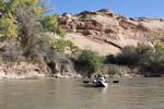
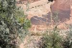
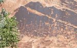
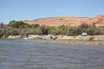
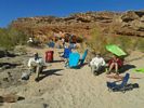
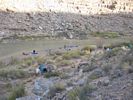
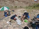
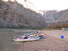
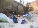
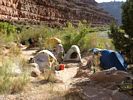
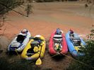
Day 1: Launched from Sand Island near Bluff Utah. Camped at River Mile 23 near Mexican Hat Utah. We drifted by examples of the Moqui Steps, and the Butler Wash Petroglyphs that could be seen from the river.
 |
 |
 |
 |
 |
 |
 |
 |
 |
 |
 |
 |
 |
 |
 |
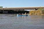
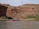
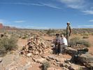
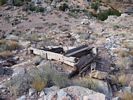
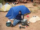
Day 2: We paddled through the town of Mexican Hat and later in the day hiked up to the Mendenhall cabin site. We camped near river mile 33 the second gooseneck below Mendenhall Cabin.
 |
 |
 |
 |
 |
 |
 |
 |
 |
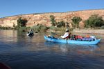
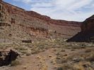
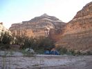
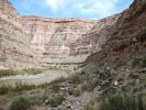
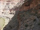
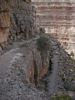
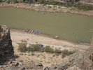
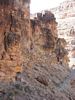
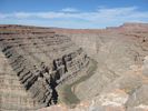
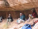
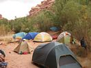
Day 3 and Day 4: We spent the third day paddling through the meanders of Goosenecks State Park. We camped at the base of the old prospector's trail known as the Honaker Trail. This is at river mile 44-45. On Day 4, we hiked the old trail to the Rim.
 |
 |
 |
 |
 |
 |
 |
 |
 |
 |
 |
 |
 |
 |
 |
 |
 |
 |
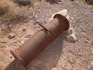
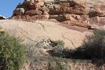
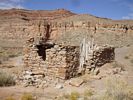
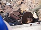
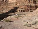
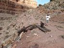
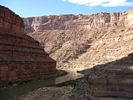
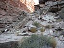
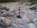
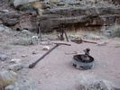
Day 5:This was another long day of paddling, but it brought us to a very interesting side canyon, Slickhorn Canyon. This place was the site of early 20th century oil drilling explorations. The mouth of Slickhorn Canyon is at river mile 66.
 |
 |
 |
 |
 |
 |
 |
 |
 |
 |
 |
|
 |
 |
 |
 |
 |
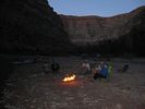
Day 6: The nature of the river changed below Slickhorn Canyon. There were no more riffles or rapids. The effect of Lake Powell causes the river to drop the majority of its silt load along this stretch of the river. The slower current meant much more paddling. Our river travel on this day was about 11 miles to river mile 77. Weather was a concern. It began to rain on this day.
 |
 |
 |
 |
 |
Day 7: This was the shortest paddling day of the trip. There were many sandbars in the river channel that had to be negotiated. We were constantly criss-crossing the river looking for water deep enough to float the boats. Several times we had to get out and drag them short distances. But we made steady progress and made the 6 miles to Clay Hills by late morning.
 |
 |
 |
 |
 |
| Trips |
| Home |